|
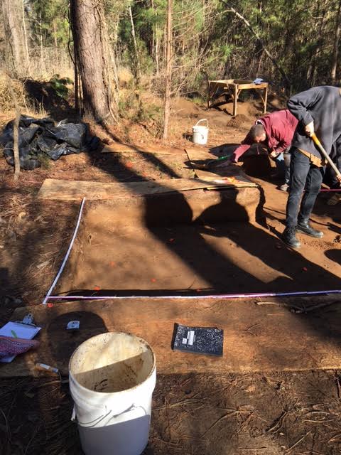
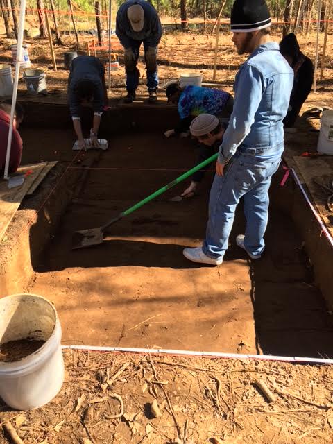
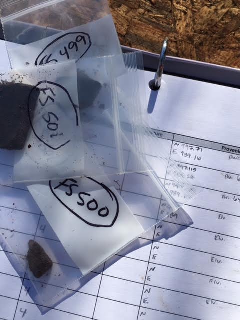
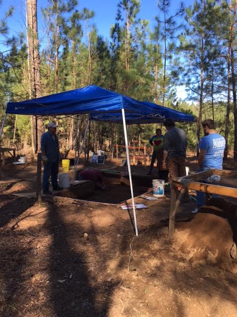
We left Day 5 still working our way down through level five. We had left our unit (Unit 4) with several artifacts flagged and still in situ in the floor. The entire time going through level five the last week we were using shovel scraping to take off very thin layers. When we felt or heard the shovel scrape or hit something we would stop, find what it was hitting, and then flag it. Once the floor became too crowded with flags to continue digging, we would map where each individual artifact was located, including a northing, easting, and elevation. This method is called piece-plotting. Each artifact was then placed into its own individual bag. This will allow researchers to come back and look at our notes and paperwork and reconstruct exactly where each individual artifact was located in the ground. Every time we dig we are destroying the site, and anything that is moved cannot be put back to exactly how it was. Therefore, it is extremely important for us to do things like this that will allow the site to be reconstructed by future researchers if they should have need to do so. So we started Day 6 dealing with the artifacts we had left flagged from the previous week. Once we had finished our mapping, we continued down through level five. Unlike our previous levels, we were digging based upon natural levels. So the level would end when the soil color began to change. Dr. White wasn’t entirely sure whether this sediment zone (Zone 2) was an intact prehistoric deposit or a second plow zone. Eventually we started to find our answer. After some more shovel scraping, we began to see sharp lines in the floor of our unit. We set up two tents to provide shade over the unit so that the light was all the same. In the sunlight shining through the trees it was quite hard to make out more subtle differences. Once the tents were in place, it was quite easy to see sharp changes in the color of the soil.They looked very similar to the plow scars that we had seen at the base of the previous level and were in a cross hatched pattern across the floor of our unit, and continued into the unit directly south of ours. One interesting thing to note is that the artifacts that we were finding were only being found in the dark soil synonymous with level five. Once it looked like this was the base of the level, Dr. White had us map the plow scars, and close out the level. After that we began a short arbitrary level down to 75 cm below datum. For our unit this meant digging down about another five centimeters. This was to get us completely out of the mixed stratigraphy between Zones 2 and 3. We would not be piece-plotting everything we found in this arbitrary level, only things that were of special interest like large items and diagnostic pottery sherds.
As we began screening the dirt that came out of level six, the pottery sherds we were finding were different from those that we had been finding. Up to this point the pottery sherds had been black and somewhat sparkly. The pottery sherds that we were beginning to find now were more red and dull. This signifies a change in pottery style, so we are definitely getting into something different than what we have been digging in.. We finished the day in the middle of level six. Come next week we will flatten out our floor at seventy five centimeters below datum, and then start the same process that we did in level five, simply going down to the next natural level. Who knows what we will find deeper down!
0 Comments
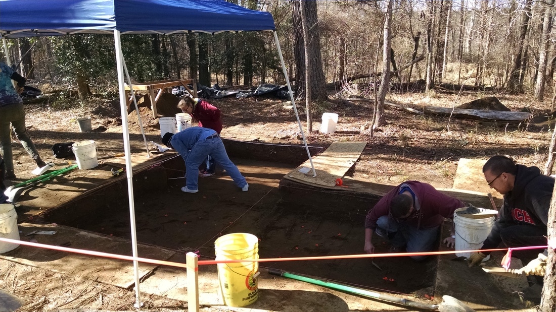
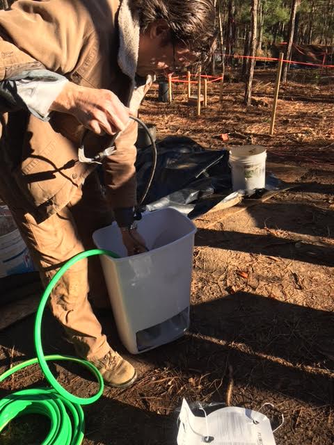
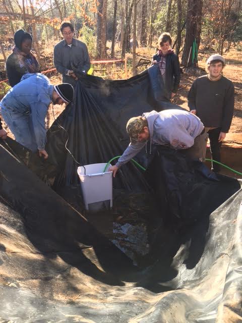
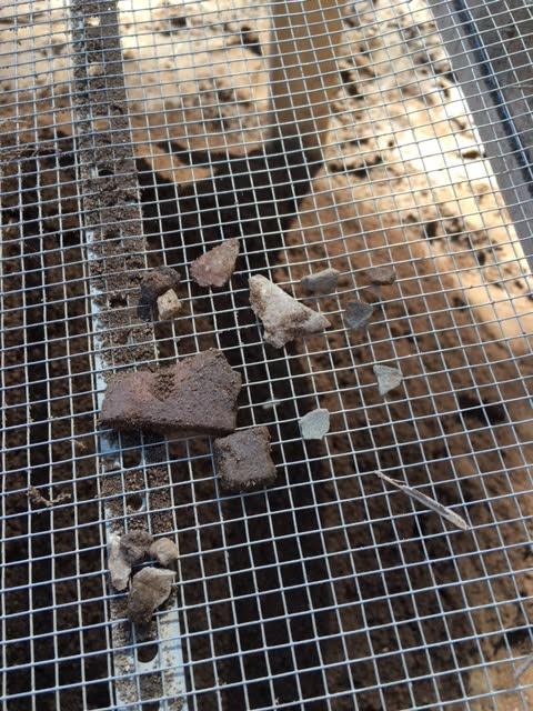
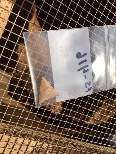
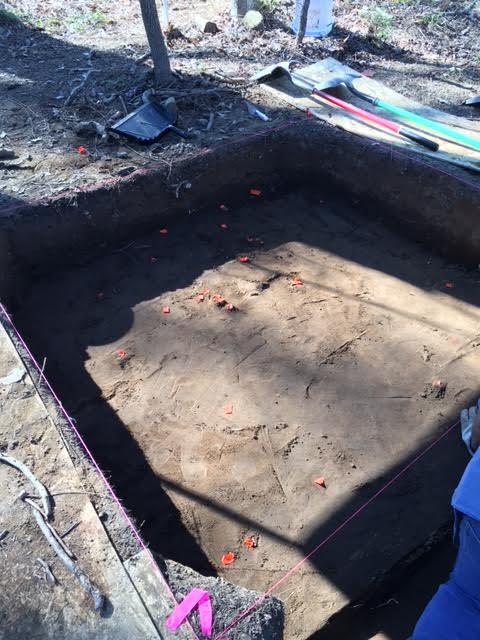
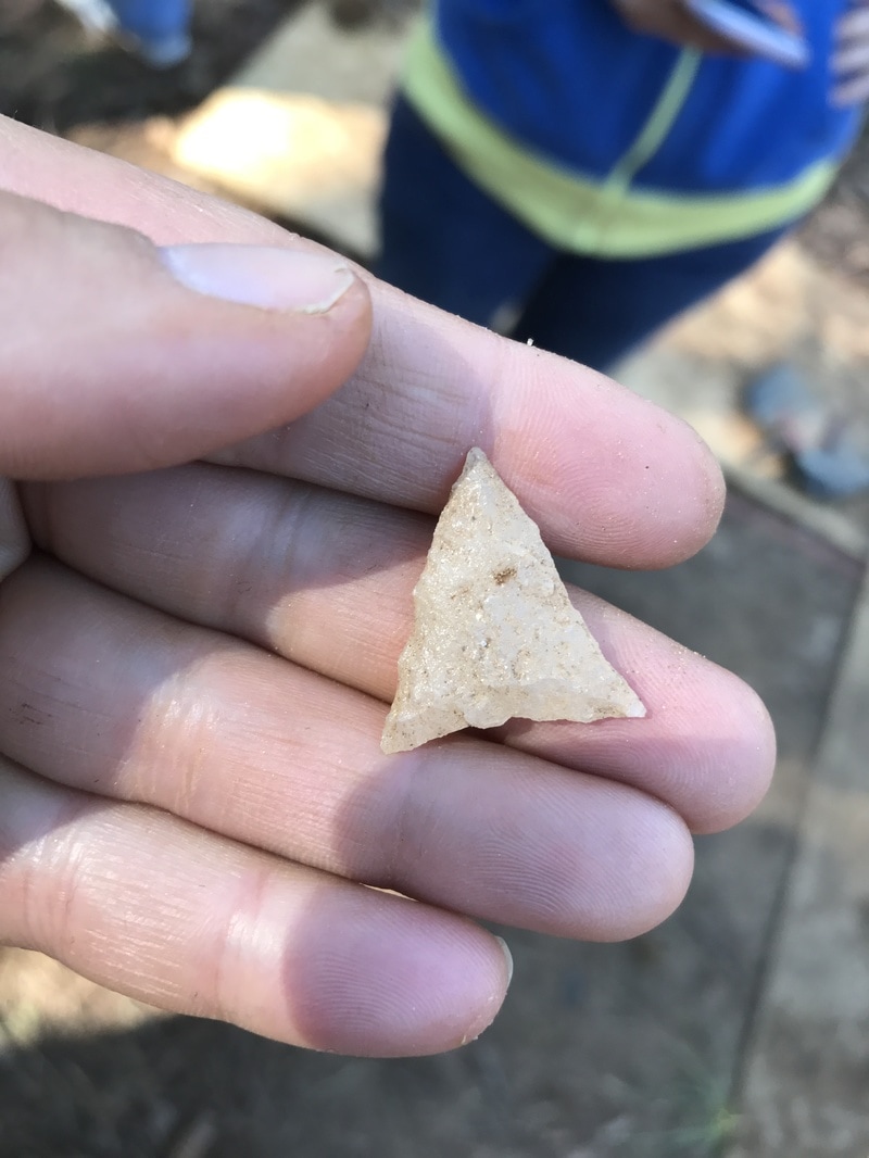
Day 6 of field school was another sunny, warm day. Honestly, I feel we’ve been very lucky with the weather this semester. It had rained over the week, and so there was water in the units. Usually, this would be removed using buckets, but Professor White wanted to test out a scavenged electric sump pump to pump the water out. It was slow. It was a team effort to lift the tarps and pool the water for removal. Professor White assembles his contraption. Slow water removal. Quite a few spiders and insects came out to see us while we pumped water. Measuring tapes are laid out on the sides of the unit so that northing and easting can be measured. Once the water was removed and the tarps were set aside, we could begin working. I was assigned to Unit 5, and we continued work on our Level 4 (within Zone 2). Last time, we began piece-plotting, and had left 13 flagged artifacts to plot. However, it appeared that one of our flagged items was actually in Unit 6, and so it was excluded from our measurements. After cleaning up the unit then collecting and preparing paperwork, we began to measure each artifact’s provenience, or place in the unit. Every item is assigned a number, then the northing, easting and elevation below a pre-determined datum was measured and recorded. Once the artifact’s provenience has been recorded, it can be removed, observed, and placed in a bag with the assigned number. Most of these artifacts were pottery fragments, rocks or flakes. These locations are also plotted on a graph on the main paperwork for the unit and zone. These measurements give an idea of artifact concentration, assist with accurate mapping, and give a record for those who review our work in the future. Shane shovels thin layers of soil from unit 5. Artifacts are placed in bags with their assigned number, and measurements are recorded separately. A pop up tent is used to shade the unit, so that any color changes in the soil can be seen more easily. When the artifacts had been marked and removed, we began work to reveal more. This takes very careful shovel skimming work. The goal is to remove very small amounts of soil, and stop when you hear o feel anything against the shovel blade. The item is marked for later plotting. This can be time consuming, and takes some delicacy. Any dirt removed is screened and artifacts are bagged together. Unit 5 had plenty of artifacts to piece-plot, and still more were missed and found after screening the removed soil. This yielded pottery fragments, rocks, flakes and a point of some sort. We worked to plot another 12 artifacts, and then flagged 27 more before ending for the day. These should be waiting for us on Day 7 when we continue our field work on the Broad River. Pottery fragments, flakes and rocks sifted from two buckets of unit 5 soil. Point sifted from unit 5 soil. End of the day's work. Orange tape indicates artifacts to be mapped.
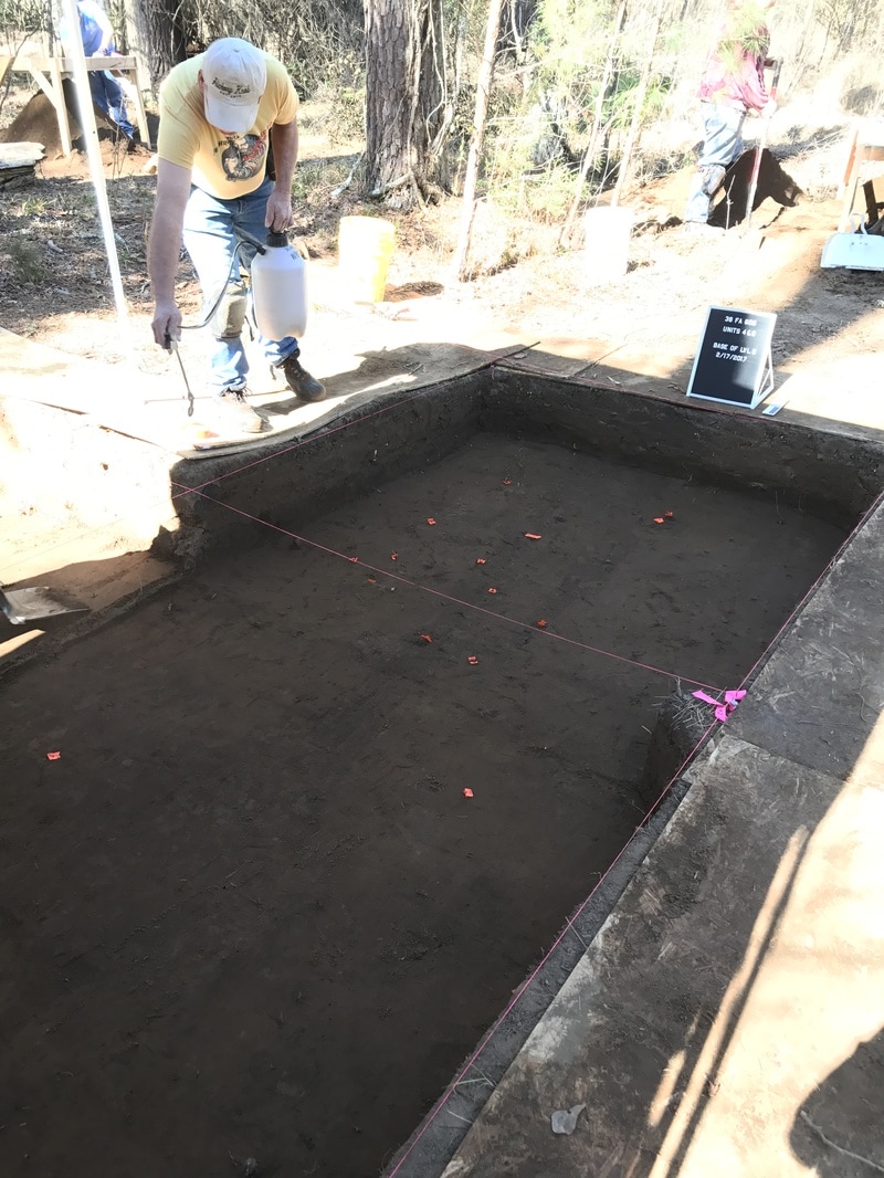 We arrived at the site around 8:45 am, this was our first week without Jim Legg on site and so we discussed and redistributed several people to begin work on a new unit in what we have begun to call the “downstairs” area at the bottom of the hill. Due to the rain of the previous week we spent the first 30 minutes or so testing our new pump to remove the water that had accumulated on the plastic covering over our units. It may not have been faster than our previous practice of passing buckets along a line but at least now we know how to use the pump. My unit (Unit 6) had ended the previous week on our fifth level with shovel skimming and piece-plotting as well as mapping. We had a new member added to our unit who had been working with Jim on the downstairs wall the previous weeks so after bringing him up to speed and closing out the paper work on level five we received instruction to scrape our unit and bring it flush with a neighboring unit so that we could have a clearer view of the plow scars we have been following. We erected tents to control the lighting, sprayed the level down with water, and took our photographs with the board. The plow scars seem to run primarily north-south and after careful consideration we decided to excavate level six as an arbitrary level, this time aiming to move down only 5 cm, piece plotting any large/interesting artifacts, and ending with a depth of 75 centimeters below datum. After breaking for lunch, we discovered an inconsistency in our depths in the southwest corner of our unit. My records show that on the morning of day 5 either we miscalculated or the rain raised us 2-3 centimeters from where we had previously measured. At any rate, we leveled off at an even 75 centimeters all around and plotted several large rocks as well as what is possibly our first cultural feature. Dr. White encircled the area and we scraped the rest of the unit to finish our mapping and paperwork. The neighboring unit also unearthed our team’s first projectile point. We ended the day with level six and after filling out the requisite paperwork, we cleaned up the site and headed home. Dr. White continues to be concerned with the drains under the small bridge we use to cross a creek. He seems to be at odds with a family of beavers. |
Student Blog (2017)Blog posts written by the students of the 2017 Broad River Archaeological Field School Archives
April 2017
Categories
All
|
 RSS Feed
