|
We left Day 5 still working our way down through level five. We had left our unit (Unit 4) with several artifacts flagged and still in situ in the floor. The entire time going through level five the last week we were using shovel scraping to take off very thin layers. When we felt or heard the shovel scrape or hit something we would stop, find what it was hitting, and then flag it. Once the floor became too crowded with flags to continue digging, we would map where each individual artifact was located, including a northing, easting, and elevation. This method is called piece-plotting. Each artifact was then placed into its own individual bag. This will allow researchers to come back and look at our notes and paperwork and reconstruct exactly where each individual artifact was located in the ground. Every time we dig we are destroying the site, and anything that is moved cannot be put back to exactly how it was. Therefore, it is extremely important for us to do things like this that will allow the site to be reconstructed by future researchers if they should have need to do so. So we started Day 6 dealing with the artifacts we had left flagged from the previous week. Once we had finished our mapping, we continued down through level five. Unlike our previous levels, we were digging based upon natural levels. So the level would end when the soil color began to change. Dr. White wasn’t entirely sure whether this sediment zone (Zone 2) was an intact prehistoric deposit or a second plow zone. Eventually we started to find our answer. After some more shovel scraping, we began to see sharp lines in the floor of our unit. We set up two tents to provide shade over the unit so that the light was all the same. In the sunlight shining through the trees it was quite hard to make out more subtle differences. Once the tents were in place, it was quite easy to see sharp changes in the color of the soil.They looked very similar to the plow scars that we had seen at the base of the previous level and were in a cross hatched pattern across the floor of our unit, and continued into the unit directly south of ours. One interesting thing to note is that the artifacts that we were finding were only being found in the dark soil synonymous with level five. Once it looked like this was the base of the level, Dr. White had us map the plow scars, and close out the level. 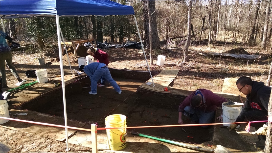 Excavations in progress at the base of level 5 in Unit 4 (unit to the right in the image). After that we began a short arbitrary level down to 75 cm below datum. For our unit this meant digging down about another five centimeters. This was to get us completely out of the mixed stratigraphy between Zones 2 and 3. We would not be piece-plotting everything we found in this arbitrary level, only things that were of special interest like large items and diagnostic pottery sherds.
As we began screening the dirt that came out of level six, the pottery sherds we were finding were different from those that we had been finding. Up to this point the pottery sherds had been black and somewhat sparkly. The pottery sherds that we were beginning to find now were more red and dull. This signifies a change in pottery style, so we are definitely getting into something different than what we have been digging in.. We finished the day in the middle of level six. Come next week we will flatten out our floor at seventy five centimeters below datum, and then start the same process that we did in level five, simply going down to the next natural level. Who knows what we will find deeper down!
0 Comments
Leave a Reply. |
Student Blog (2017)Blog posts written by the students of the 2017 Broad River Archaeological Field School Archives
April 2017
Categories
All
|
 RSS Feed
