|
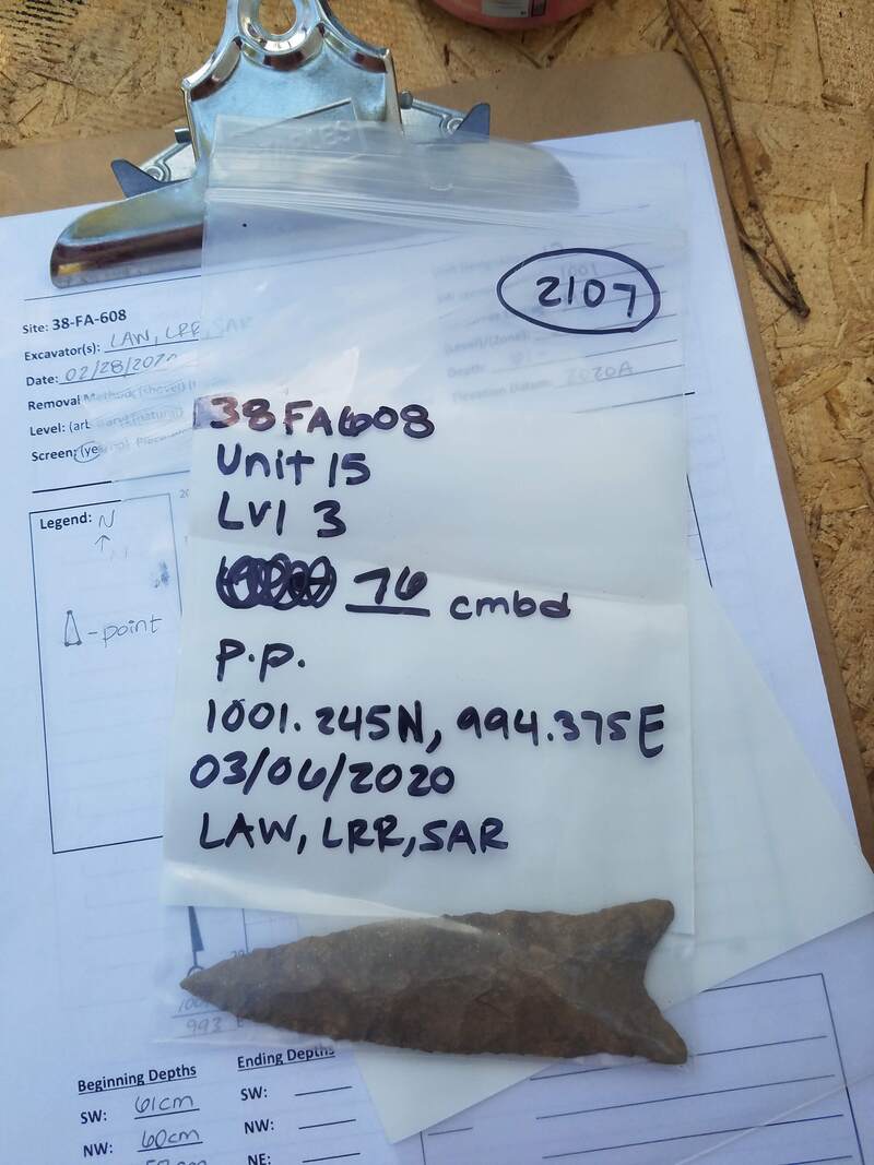
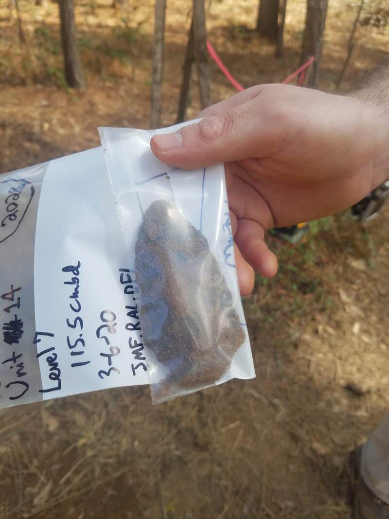
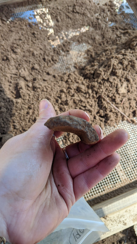
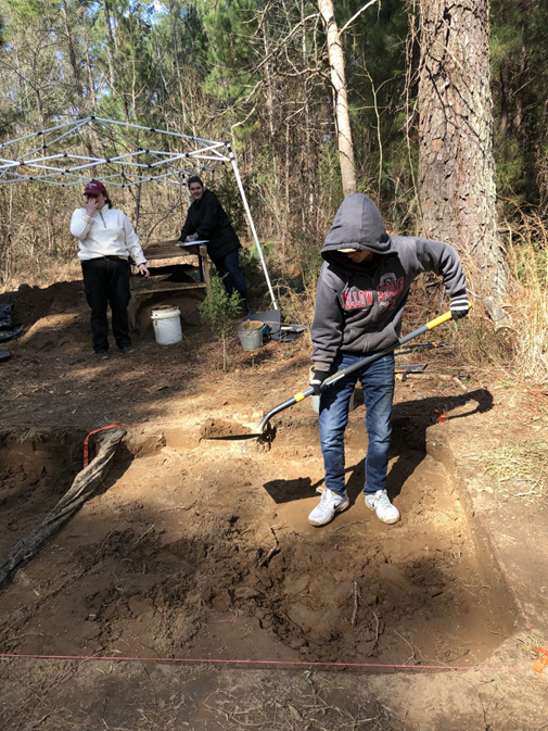
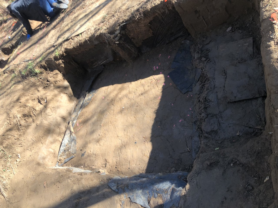
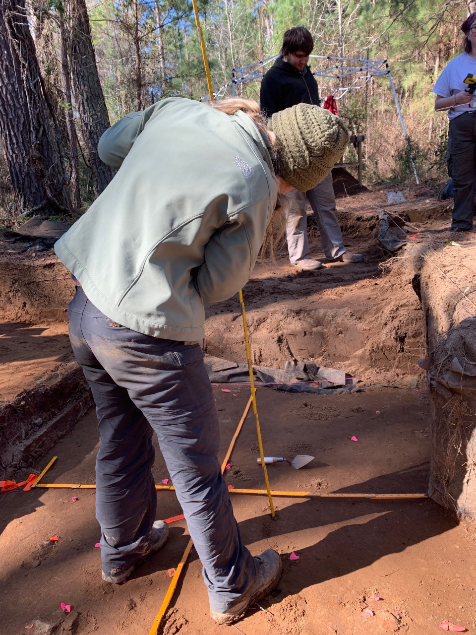
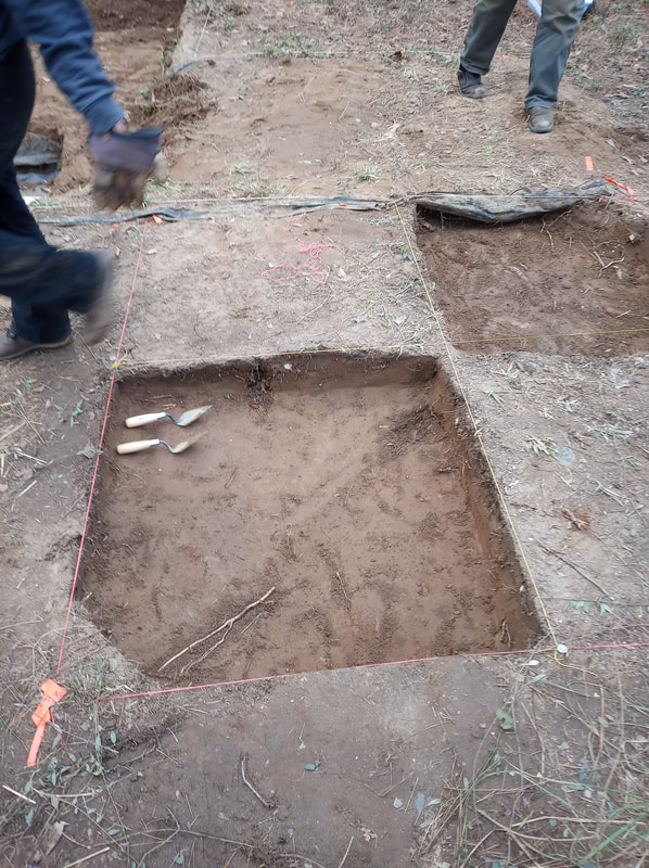
Unfortunately, Friday March 6th ended up being our last day of field school due to in-person classes being cancelled the rest of the semester because of COVID-19. I plan on taking this class again next spring because I am very sad the excavation was cut short and I did not get to continue learning all the field school skills this class intended to teach. I had been assigned to Unit 14 with Robert and DuVal all semester, and the previous week we stopped excavating midway through Level 6. We started Level 6 at 100 cmbd (centimeters below datum) and ended it at 110 cmbd, as we had planned to make all levels (after getting deeper than undisturbed dirt) a thickness of 10 centimeters. After finishing Level 6 I realized I had been doing the sketches for each level wrong. The sketch for a level is supposed to be what the unit looks like at the end of the level, but I had been drawing what it looks like at the beginning. Luckily there is an easy way to go back and fix this error, as the sketch I drew for the beginning of Level 4, can be transferred on paperwork to represent the end of Level 3, as they are the same thing. After we closed out Level 6 and finished paperwork, we started Level 7 and had time to finish it and close it out at 120 cmbd. In Level 7 we found a Savannah River projectile point in context! This was the first projectile point we had found in context in Unit 14. Earlier in the semester we had found a Savannah River point and a Morrow Mountain point both in slump, that likely came from dirt that would have been part of Unit 14 if it didn’t collapse. As we got deeper into the unit we started finding bigger pieces of fire cracked rock, more, and bigger flakes, but less ceramics. Level 7 did not have any ceramics. 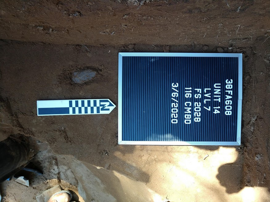 Savannah River point in situ in Level 7 of Unit 14. While Robert, Duval, and I were excavating Unit 14, Dr. White was clearing dirt downstairs, to make it possible to excavate the “basement” in the following weeks. The basement is the area in the ground deeper than the floor of the “downstairs.”
“Upstairs” in Level 3 of Unit 15, a massive Yadkin Point was found. Al Goodyear, an archaeologist who discovered site 38FA608 along with Dr. White, was in class this day and said it was probably the biggest Yadkin point ever found in South Carolina. Overall the day was very exciting, mostly due to finding the Savannah River and Yadkin points. However, this class period was a very unexpected and unfortunate end to the semester.
0 Comments
The day began as usual. We arrived at the site without any hindrances, bucketed water out of the main block, and gathered our necessary supplies. Coffee was brewing and we were ready to get to work! Sami, Lelia, and I continued taking down Level 3 of Unit 15. I was excited to be assigned as Unit Leader this week. The process continued, at first, as the other levels had: scraping the walls while trying to keep them from bowing or getting cut in, shoveling out most of the dirt from the level while cutting and removing roots ranging from fine threads to 4 cm, and when getting low enough, troweling the final layers of dirt. However, this level had a surprise in store for us. We were supposed to be taking Level 3 down to be even with the floor of Unit 12, the one next to ours, or to a color change in the soil. There was a potential feature in Unit 12 that Dr. White wanted to see if it continued into our unit, Unit 15. (As it turned out, if it was a feature, it didn’t extend very far into our unit.) I asked Dr. White to come check on my progress to see if I was at the depth he wanted. He borrowed my shovel to show me where to stop and as he slid the shovel along the floor, he hit something. Getting down to investigate further using his trowel, Dr. White removed the surrounding soil to reveal a Yadkin point!
Dr. Albert Goodyear happened to be visiting the site that day after lunch and he was very eager to remove the point. We waited until we had finished clearing out the remaining soil in the level and cleaning it up with our trowels. I found it was difficult to get the small piles of excess dirt out from around the point and the two quartz flakes near it. One of the flakes was so loose already it was no longer lodged in the soil and we just bagged it. Sam showed me how to plot the point on our table and taught me how to measure its location in the block. After it was plotted and the level was finished, Dr. White removed the flag, set up a board with the information for the site and unit on it, and took photographs of the point in the soil. Sami, Lelia, and I helped by using fabric to shade the area from the sun to get better lighting. Once the point was removed, we all gathered around to look at it as Dr. White and Dr. Goodyear examined it. They hypothesized that the point was probably the largest Yadkin point to be found in South Carolina. After the excitement of removing the point passed, we bagged it and moved along to finishing up at the site. However, our unit wasn’t the only one to yield an exciting find that day! Robert, Duvall, and James were continuing their work on the wall comprising Unit 14 and they found a Late Archaic point! Near the wall in the “downstairs,” Dr. White and Fletcher were clearing out back dirt to reopen a unit down there. Dr. White will be excavating some deep units in that part of the site to potentially reveal more about what is deeply buried there. All-in-all, it was a very nice day! Points were found, coffee was consumed, and we took a short field trip to see the Broad River after lunch. Continuous rain over the past couple of weeks had brought sand from the river up into the land between it and our site. To think of the water rising that high up its banks and overflowing was astounding.
Unfortunately, that day would be our last day in the field for this semester. As the University continues to take steps to prevent the spread of COVID-19, face-to-face instruction has been suspended. I am so sad our time in the field is being cut short, but I am grateful for the experience we had and for everything we’d learned so far. It was a really great group, we learned a lot and had a lot of fun, and our last day was beautiful with two amazing discoveries. I couldn’t have asked for a better first experience in the field!
Today was a great day out in the field. Laura brought coffee and creamer for Dr. White’s coffee maker. Cate and I continued work on Unit 16. Our task for the day was to turn our 1x1 into a 2x2. With our south east corner already down to 50 cmbd, we started on the south west corner. Cate and I traded off between screening the dirt and digging. While screening, we mostly found stone flakes and small ceramic sherds. We finished the day by bringing the north east corner down to 50cmbd. The whole process took longer than I expected, but in the end I was very pleased with our work. Not bad for my first unit. :)
This week at field school we had beautiful weather. It was a cool day, but the sun was shining so the site was mostly kept at a warm temperature. There had not been much rain the previous week, so removing the tarp from the unit was a mostly easy task. We had coffee today, so that kept people in high spirits!  No caption required. Lelia, Laura and I continued work in Unit 15. Our task today was to finish removing level 2, the transition between the first and second plow zone. We used a shovel to remove most of the dirt and it was easy to tell where we needed to stop because the base color of the dirt was significantly darker and we could see plow scars. The digging was slow going due to the number of roots, large and small that run through the unit. There are so many roots because of a tree that had to be cut down at the beginning of starting this unit. The stump is still present in the unit and sits 13.5 cm into the north wall of it. The large roots from the tree have been our constant foe while digging in Unit 15, but despite the slow pace we were finally able to get to the bottom layer. Throughout the removal of level 2 we were constantly screening the soil through a ¼” screen to check for artifacts. We found a lot of small pieces of quartz, some fire cracked rock, and a few pieces of pottery. Once we reached the bottom of level 2, we cleaned up the unit by removing all remaining loose dirt with trowels and making the unit floor level. This was so that we could clearly see the plow scars. We recorded the soil color of the base layer and then then two other colors, one that was slightly lighter and caused by the plow, and an even lighter one from roots.  Scraping the floor of Unit 15 at the base of Level 2. After recording everything we needed. We began to remove the soil from level 3. The goal is to get the floor of our unit level with the floor of Unit 12 so that we can excavate a feature that is in both units. To start we filled out the form for the excavation and then created a bag for artifacts screened. We did not get very far into level three, but we did find a lot of fire cracked rock and stamped pottery, which was very exciting!  A piece of Mississippian age complicated stamped pottery from Level 3 of Unit 15. This week was the third week in a row that we had a full day of sunshine and decent temperatures. We are also getting into the groove of getting to the site, unloading the toolbox, removing the tarp and starting on our individual projects. Last Friday, February 21st, Laura, Robert and I leveled all the 1m x 1m quadrants of Unit 15 to create the entire 2m x 2m unit. Once unit 15 was ready to have level 2 removed, I was put in charge of removing the natural layer to the darker soil under the upper plow zone. This week we had Laura, Sami and me working to finish removing level 2 soil out of the unit so that the plow scars would be noticeable before bringing the unit down through level 3. The purpose of this unit is to expose the feature (Feature 16) that appeared to extend into Unit 15 from the unit to the east. Unit 16 is also coming down as well due to a possible feature in the southeast corner of Unit 6. When we leveled the unit by a natural layer, we then worked from east to west with trowels to uncover the color mottles that were not as noticeable once the soil had dried out. The Munsell color for the main part of the unit was 10YR3/4 with two lighter mottles of 10YR4/6 and 10YR5/4. The ending depths of our unit were between 58cm and 61.2cm below datum across the unit. In the transition between upper and lower plow zone, we were finding higher numbers of much larger flakes, fire-cracked rock, and pottery sherds. An interesting rim sherd in particular we found and it has incised markings on the rim. When we started level three Laura was put in charge of the unit and we were also finding some complicated stamped pottery sherds. Larger amounts of flakes and larger rocks along with the higher number of pottery are normal for the lower plow zone. This is because when this area of land was plowed, artifacts from the lower strata were brought up and mixed together with upper layers.
Kieran and Sam were in the northern half of Unit 4 and southern half of Unit 6 working on piece plotting. Sarah and Robert were working in Unit 3 and they were piece plotting while digging further down the strata. This was also the second week in a row that Unit 14 downstairs was not collapsed due to rain and flooding which is always a plus.
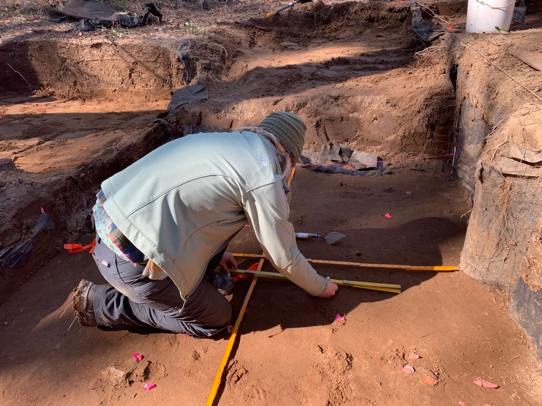
This week in the field we had another reprieve from the rain; however, it was one of the coldest days we’ve been out so far. Once we’d pumped out the leftover rainwater and uncovered the main block, Sam M. (Sam) and I picked back up piece plotting from where we’d left off the week before. Piece plotting is locating the exact 3D coordinates of an artifact within the established grid system at the site. Sam. and I worked together to first finish the SE quadrant of our unit. I measured the northings, eastings, and centimeters below datum (cmbd) of each artifact with the4 laser level and read them out to Sam so she could record them on the FS log and unit paperwork. After completing the SE quadrant, we moved on to the NW and finally finished our current level of piece plotting with the SW quadrant. We stopped for lunch halfway through piece plotting our final SW quadrant and finished up the remainder of the unit shortly afterwards.
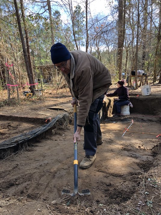
After lunch I checked in with what stage of excavation everyone else was at with their units. Over the course of the morning Cate and Zoë finished digging down and screening 50 to cmbd in the SE 1X1 meter quadrant of Unit 16. They were moving on to the SW corner of their unit when I caught up with them. 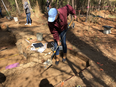 Zoe excavating in Unit 16. In Unit 15 to the north of the main block where Sam and I have been piece plotting, Lelia, Laura, and Fletcher had reached 40 cmbd and are now working on Level 2 across the whole 2x2. They are excavating it as a natural level, identifying the end of the level by soil color change.
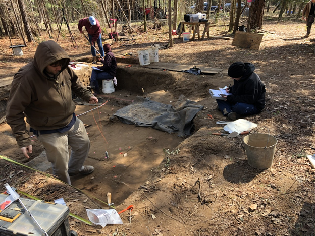
After our lunch break Dr. White was working beside Lelia, Laura, and Fletcher in Unit 12. He was removing backfill dirt from the unit to re-expose half of a feature located at the base of the second plow zone. The other half of the feature will be located in Unit 15, and Lelia, Laura, and Fletcher were working on excavating down to it as well. Meanwhile, Robert G. and Sara R. were setting up to piece plot in unit 3.
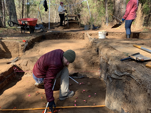
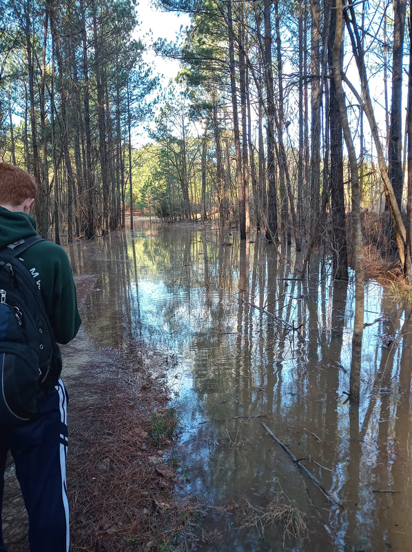
Down below the main block, DuVal, Rob L., and James were excavating Unit 14. They had reached Level 4, which was at the bottom of the second plow zone, and were recovering a high quantity of ceramic sherds. 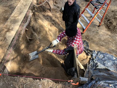 Excavating Unit 14. For the remainder of the day Sam M. and I worked on piece-plotting the next level down in our unit, which was located in the southern half of Unit 4 and the northern half of Unit 6. Sam M. and I confirmed with Dr. White that that our next step after piece plotting all the artifacts that easily popped out with a trowel at our current level was to shovel scrape down to better expose the artifacts that didn’t easily pop out. We began shovel scraping in the north half of our unit, and switched to troweling because it worked better to remove the dirt around the artifacts we were preparing to remove. Once we’d pedestalled the artifacts on the north half of the unit (the southern half of Unit 4), we stopped troweling and piece-plotted the exposed artifacts. Sam and I finished piece plotting the next level of artifacts in the north half of our unit before it was time to pack up for the day.  Done for the day with the unit floor protected by landscape fabric and plywood before replacing the tarp. Over the past month, it has been very wet. We have had days we could not work at the site and we have had days where we had to hike in, due to flooding, instead of driving. The amount of water that has been dumped onto the site and the surrounding area has been immense. I heard something along the lines of record setting one day on the news…something like since December 1, 2019, until now, these three months, having received the most rainfall in recorded history. The ground really is quite saturated. The nearby Wateree River reached very high levels, destroying many peoples’ property with the quick rise, although there may be other factors at play there, to be honest. The Broad River level at the site increased by 15 to 20 feet.
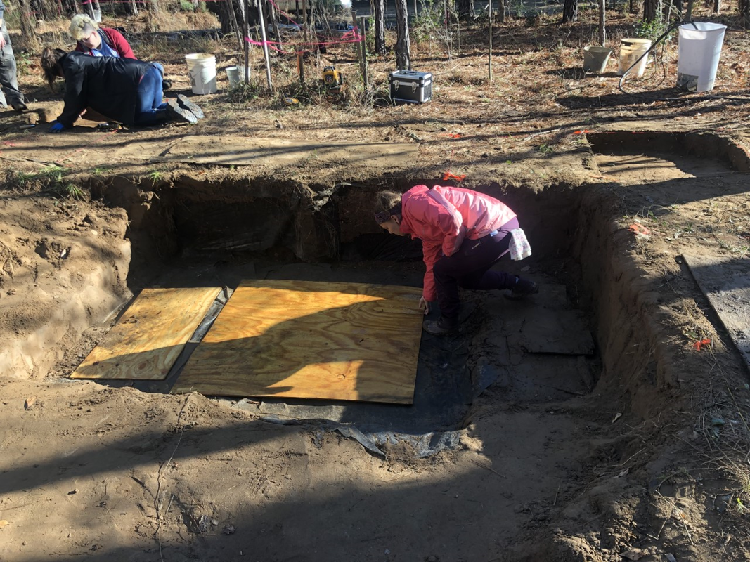
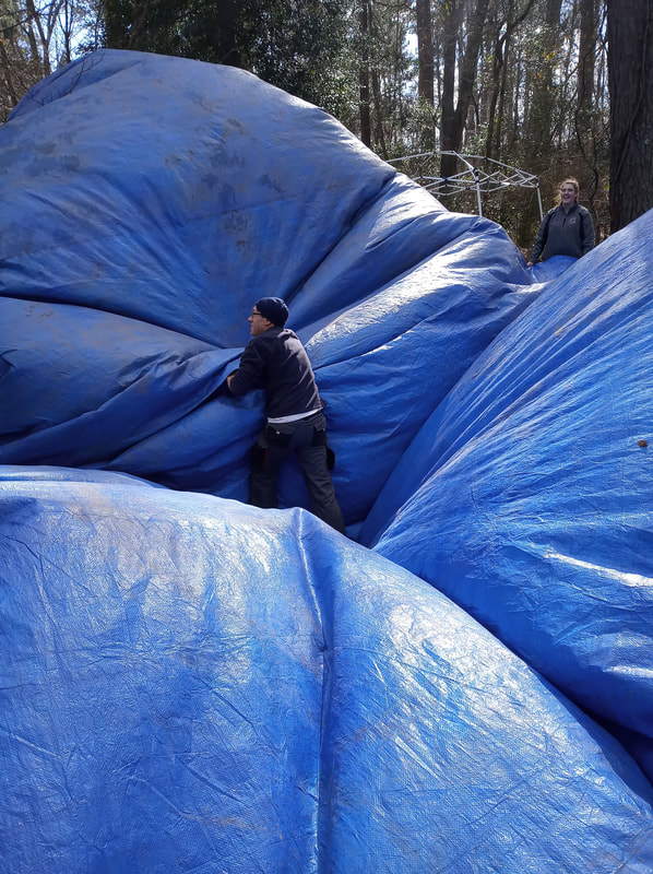
The drive in was difficult. The road had been reduced to a muddy path, and large chunks of it had washed away. Access to the site was unusually difficult. All of this water has had an extreme effect upon the site. The landscape surrounding the site has changed. Portions of the exposed wall had collapsed. In fact, the water was probably 4 to 6 feet up on the wall, meaning, large portions of the wall were submerged and possibly damaged. The excavation block in the upper area was not damaged to anywhere near the same extent as the wall. It is on the highest ground in the immediate area, and therefore, it did not have run off coming through it. However, the block was quite full of water. Our experience of the subtle art of tarp pulling became necessary on this particular day. The difficulty was ensuring we removed all the water with none of it getting into the pit, as that could do damage to the excavation. We had to carefully tug the tarp from the sides to ensure all the water ran to the middle, where there was a pump…yet, still ensuring the pump was in enough water to not run dry…and also ensure that you were not dumping water from a lower fold of the tarp into the pit. After great effort, cooperation and care, the team finally experienced success in this task. It was rewarding to see such a seemingly small task become such a group triumph. Once we had access to the block, Leila and I continued work on excavating through the plow zone in Unit 15. We worked in a 2x2 unit by excavating 1x1's so that we could get practice with forming baulks, walls, and floors. We did not see much, and anything we did see was out of context. As discussed in my last post, the context was fairly well eradicated. Unlike any other day so far this season, we got to spend a full day on site. When recovering the site, we were intentional to put the tarp in place so that we did not attempt to fight the water. It is a fight we would lose. This looked like ensuring that the tarp was not suspended over the pit, but instead sitting in the pit to create a pool so that next time, we could either via pump or bucket, extricate the water without damaging the site. We think we did this appropriately. This was fun, as we had a tarp the size of Rhode Island! This week we had a well-deserved break from the rain and flooding of the site. We were able to drive right up to the site with the trucks; however, the ground was very muddy for most of the day. Some water remained pooled in the tarp when we arrived and had to be drained off the block using a pump. Down below the block, Rob L. caught me up on the status of their excavations. Unfortunately, a third wall slump occurred in Unit 14, where he, DuVal, and James had been working the previous week. It was clearly visible along the black tarp covering the wall how high the water had come up.  The mud on the tarp marks how high the water got. I spent the day learning to piece plot artifacts on the floor of a unit from Sam M. Piece plotting is finding the exact 3D coordinates of an artifact within the established grid system at the site. Within the main block we spent the morning setting up to piece plot in a 2X2 meter unit in the south half of Unit 4 and the north half of Unit 6. We began by removing the remaining coverings from the unit floor.
Normally when setting up the grid to piece plot one would start with the SW corner as the origin (0,0); however, Dr. White wanted to leave that corner covered for now to protect it from the elements. So, we began with a trusted point that had already been mapped out, which was located exactly at the middle point between Units 4 and 6 (on both X and Y axes if you’re imagining a grid). From our original trusted point we triangulated in 3 other points to form four 90X90 centimeter units within the 2X2 meter unit we’d be piece-plotting in. We mapped out these points in order to establish known grid points within our 2x2. Once we had the points mapped out with nails and labeled with their respective northings and eastings using flagging tape, we recorded our unit and mapping points on FS log paperwork. Once we actually began piece-plotting the artifacts on the unit floor, we would record their exact 3D locations in the paperwork as the artifacts were removed.
After setting up our paperwork, Sam M. placed chaining pins into the north and south edges of the unit and we tied string between the NE-NW and the SE-SW pins. Next, I utilized a laser level to measure the starting depths of our unit floor in centimeters below datum (cmbd). I took measurements of the NE, NW, SE, and SW corners, along with one measurement in the middle of our unit at our original trusted point. Sam M. recorded the elevation of all five points in our paperwork and then we stopped for lunch at about 11:30AM. After lunch Sam M. and I quickly troweled the bottom of our unit to remove loose dirt and better expose the flagged artifacts. We also flagged a few more artifacts that we felt while troweling. Dr. White took a picture of our freshly troweled unit for his records. We utilized ¼” screens to check our loose dirt for any artifacts and found several flakes and a small fragment of burned clay. Next Sam M. laid out two folding rulers on the floor of our unit over our mapped-out X and Y axes. 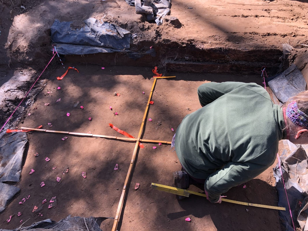 Placing rulers to aid in mapping. Now that the set up process was completely finished we began piece-plotting in the NE quadrant of our unit. I identified the northings and eastings of each artifact and read them off for Sam M. to record in the FS log and map out on the paper grid. Then, I removed each artifact carefully with my trowel and handed it to Sam M. before measuring its elevation with the laser level.
We left in artifacts that were not easily removed in order to excavate further down to their level later on, or “pedestal” them at surface level. At the end of our day Sam M. and I were able to finish piece plotting the NE quadrant and half of the SE quadrant of our unit. Meanwhile Sam M. and I were piece plotting, Robert G., Lelia, Laura, and Sami continued excavating unit 15. Robert G. and Lelia were working in the west half of the unit and Laura and Sami worked in the east half.  Lelia flashing her signature finger gun while screening with Fletcher. At the end of the day we properly covered all the excavation units and put away the tools before heading back to SCIAA.
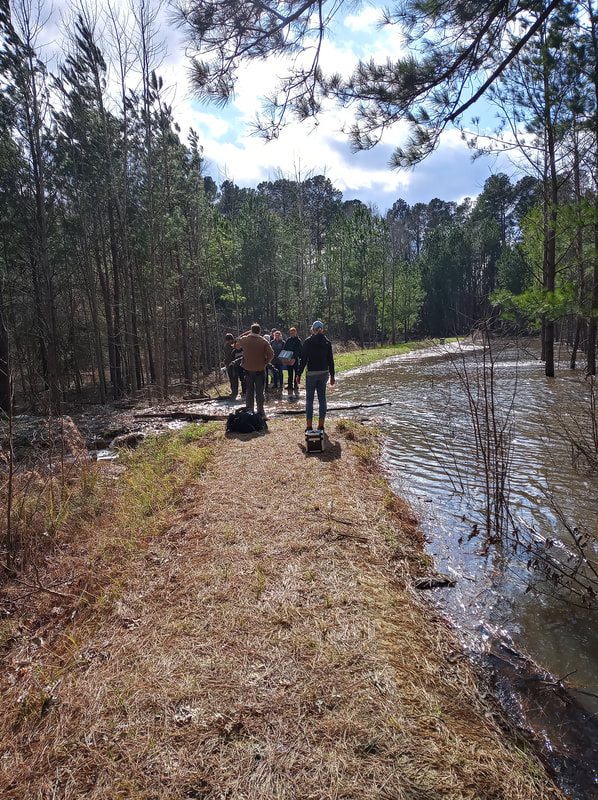
This week was our first official full day. We arrived to find no water blocking our path to the site, making set up quick and easy. We began with the usual: we unloaded the trucks, pumped water out of the block, and got the tarp moved to an open field to dry. After setting off to begin work on our designated areas, Rob, James, and DuVal discovered that the portion of the wall they were working on excavating had collapsed. The water line indicating how high the water had reached was unbelievably high. 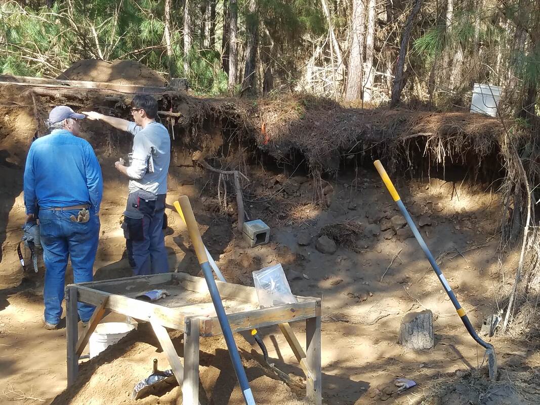 Dr. White and DuVal surveying the damage caused by flooding. Once we surveyed the damage, the rest of us got to work on our assigned units. Sami and I finished the SE quadrant of Unit 15. We removed any remaining loose dirt, checked that our walls were straight, and took our final measurements. Then, Dr. White came over and showed us how to finalize the paperwork, including using the Munsell Soil Chart to determine the color of the soil in the unit and taught us the jargon to describe soil properties, like the texture. We determined our soil was sandy loam, meaning that it’s a composite of multiple soil types but mostly made up of sand. After filing away our very first completed paperwork for an archaeological site, we began work on the NE quadrant of Unit 15. We took the initial measurements of the height below datum in centimeters and filled out the information on a new FS log entry and artifact bag. At the same time that we broke ground on the new quadrant, Lelia and Robert began digging the SW quadrant of Unit 15. Sami did most of the initial shovel work while I screened the dirt she removed on the 1/4” screen. Fletcher came over and helped Lelia and I screen our dirt.  Ready to break ground on the northwest quadrant of Unit 15. After our lunch break, Sami and I began troweling our quadrant. After troweling for a bit, Dr. White sharpened both of our trowels and we got to experience what a good, sharpened trowel could do. Man, it was so much better after it had been sharpened! However, we realized that we still had a few centimeters to go before we reached 40 cmbd (centimeters below datum), so Dr. White prompted us to use the shovel again. I began practicing taking off only small portions of dirt with the shovel and it was actually quite satisfying. As I removed what I thought to be centimeters of dirt, Sami would periodically check the depth. I say “what I thought to be centimeters of dirt” because I have found that I need to learn what a centimeter looks like. I suppose it will come with practice, but my “centimeter” was sometimes not even a half a centimeter. However, we eventually made it to 40 cmbd! Next week we will clean up any loose dirt in the NE quadrant, take our final measurements, and use the Munsell chart to describe our soil, before beginning the work to bring Unit 15 down to the next level.  A freshly sharpened trowel. The weather for our Week Four field day was beautiful. It was not too hot or too cold, so we left to head for the site excited for our first full day of work without rain. Once on the property however, we soon discovered that the road to the site was flooded, making it impassable for our trucks. It was decided that we would try to walk upstream to a dam that had been put in in the hopes that we could cross the stream there and make it to the site. After a walk down train tracks, through some woods, and across a little stream of water, we were able to walk across the dam and make our way to the site.
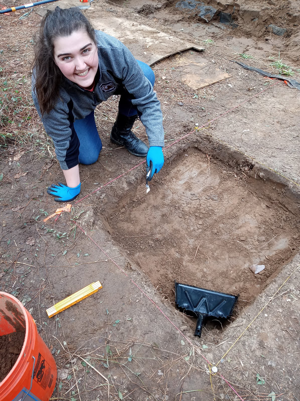
It had rained considerably the day before, so the main unit was filled with water, so we worked together to empty the units and then removed the tarp which was them placed in a nearby field to dry. After this, our work could really begin for the day. My day consisted of working to level out the southeast quadrant of Unit 15, the unit that I helped to lay out in Week 2. We worked to lower it to 40 cm below the datum (cmbd). The way that we measure elevation is by using a laser level. We use the sensor and a foldable ruler and then find out how much distance is between the ground and the laser. The datum stays on a cinder block that does not move so that it can be sensed all over the site by the sensors and it does not change heights from day to day. As we scraped the dirt using the shovels and then our trowels, we collected it in buckets, which we then take to screen in our ¼” screen. So far, in our removal of Level 1, which is the plowzone, we have found one rock, a walnut, and a lot of roots. We were able to get most of our 1x1 unit level and at the right depth, but the outer sides of the 1x1 still need to be evened out since they will be the actual sides of Unit 15 when it is completely opened and lowered.
Elsewhere other units were being worked on in a similar method. In Unit 15, the northwest quadrant diagonal to the quadrant I was working on is also being opened up. They are facing a challenge with that quadrant because there was a tree growing halfway in the unit, so there are a lot of roots in the 1x1, which they are having to contend with. Over next to the wall, a 1x3 unit (Unit 14) was measured out and then started getting opened up in an attempt to stop any more loss of the wall from the collapsing that has been happening. Unfortunately, we did have to start packing up a little bit early because of the long walk back to the trucks, but overall it was a productive day and things are really starting to get moving. When we were tarping the open units (which we do to prevent rain from getting into them) the wind proved to be tough to contend with and the giant tarp did not want to flatten itself down into the units, but eventually we were able to get the tarp into the units and weigh it down with buckets of back dirt. The tarp has to be placed into the block, and not just over it, because we don’t want to fight with the water, we want the water to collect in the tarp to protect the block. We put our tools away in the toolbox and made our way back to the trucks, the day over.
|
Student Blog (2020)Blog posts written by the students of the 2020 Broad River Archaeological Field School Archives
April 2020
Categories |
 RSS Feed
