|
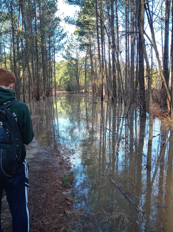
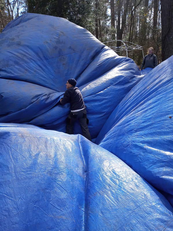
This week we had a well-deserved break from the rain and flooding of the site. We were able to drive right up to the site with the trucks; however, the ground was very muddy for most of the day. Some water remained pooled in the tarp when we arrived and had to be drained off the block using a pump. Down below the block, Rob L. caught me up on the status of their excavations. Unfortunately, a third wall slump occurred in Unit 14, where he, DuVal, and James had been working the previous week. It was clearly visible along the black tarp covering the wall how high the water had come up.  The mud on the tarp marks how high the water got. I spent the day learning to piece plot artifacts on the floor of a unit from Sam M. Piece plotting is finding the exact 3D coordinates of an artifact within the established grid system at the site. Within the main block we spent the morning setting up to piece plot in a 2X2 meter unit in the south half of Unit 4 and the north half of Unit 6. We began by removing the remaining coverings from the unit floor.
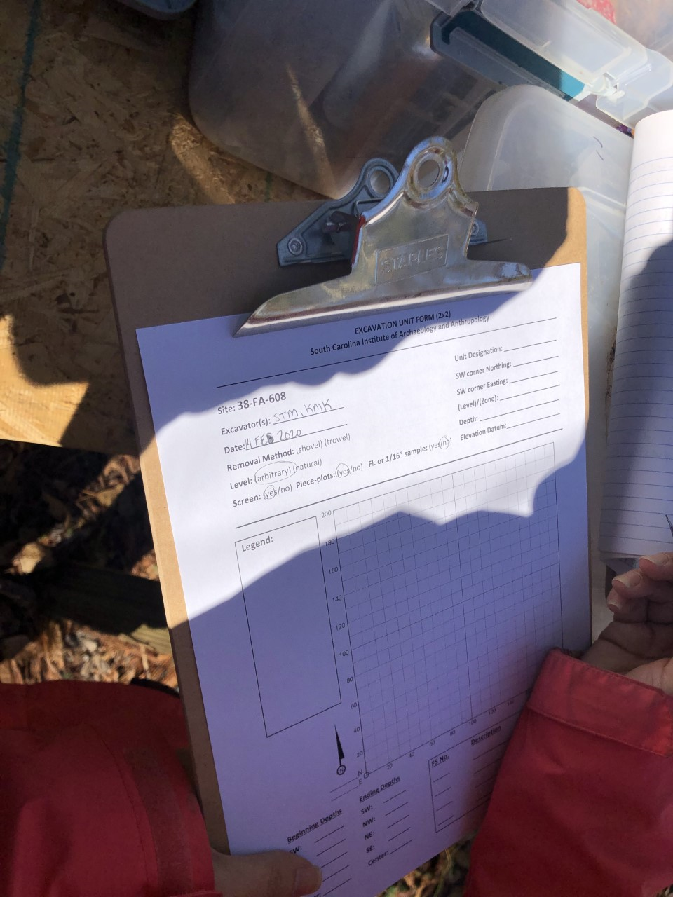
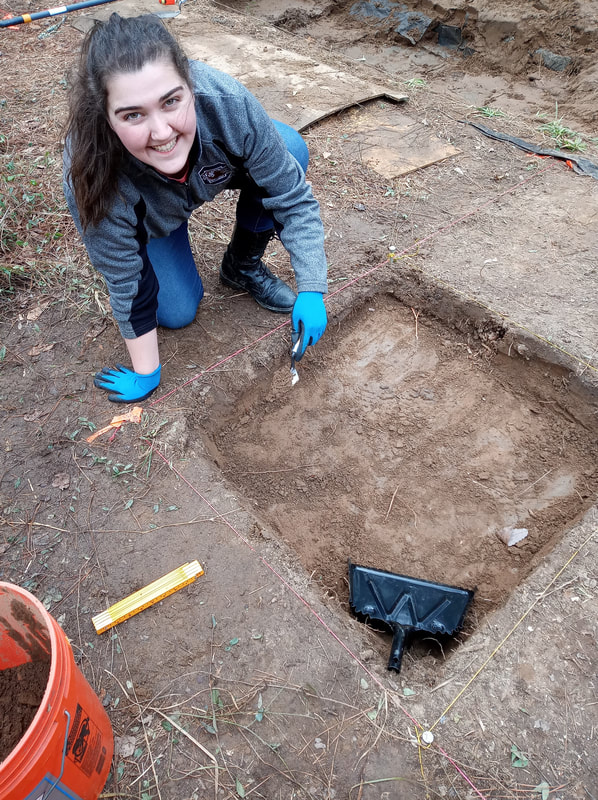
Normally when setting up the grid to piece plot one would start with the SW corner as the origin (0,0); however, Dr. White wanted to leave that corner covered for now to protect it from the elements. So, we began with a trusted point that had already been mapped out, which was located exactly at the middle point between Units 4 and 6 (on both X and Y axes if you’re imagining a grid). From our original trusted point we triangulated in 3 other points to form four 90X90 centimeter units within the 2X2 meter unit we’d be piece-plotting in. We mapped out these points in order to establish known grid points within our 2x2. Once we had the points mapped out with nails and labeled with their respective northings and eastings using flagging tape, we recorded our unit and mapping points on FS log paperwork. Once we actually began piece-plotting the artifacts on the unit floor, we would record their exact 3D locations in the paperwork as the artifacts were removed.
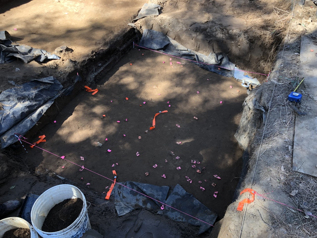
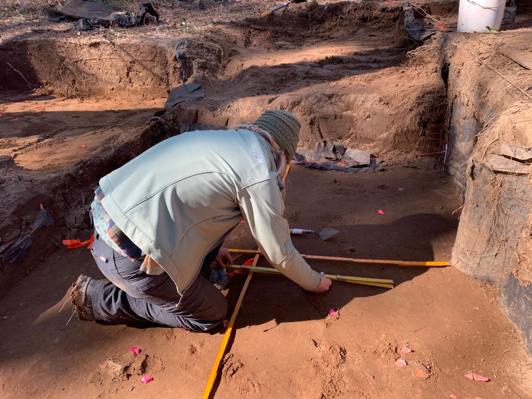
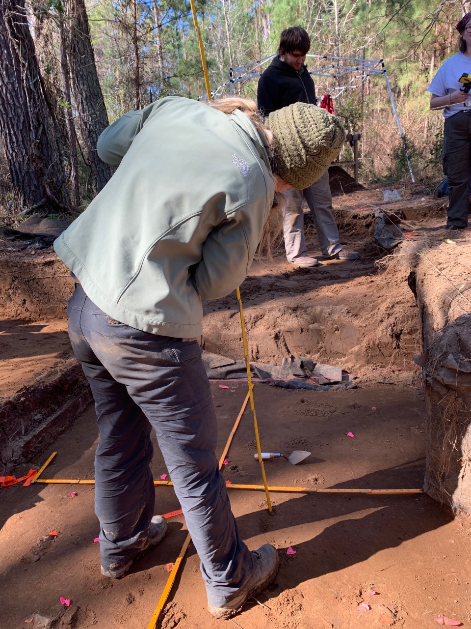
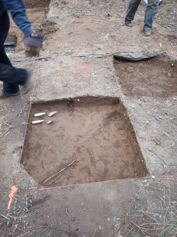
After setting up our paperwork, Sam M. placed chaining pins into the north and south edges of the unit and we tied string between the NE-NW and the SE-SW pins. Next, I utilized a laser level to measure the starting depths of our unit floor in centimeters below datum (cmbd). I took measurements of the NE, NW, SE, and SW corners, along with one measurement in the middle of our unit at our original trusted point. Sam M. recorded the elevation of all five points in our paperwork and then we stopped for lunch at about 11:30AM. After lunch Sam M. and I quickly troweled the bottom of our unit to remove loose dirt and better expose the flagged artifacts. We also flagged a few more artifacts that we felt while troweling. Dr. White took a picture of our freshly troweled unit for his records. We utilized ¼” screens to check our loose dirt for any artifacts and found several flakes and a small fragment of burned clay. Next Sam M. laid out two folding rulers on the floor of our unit over our mapped-out X and Y axes. 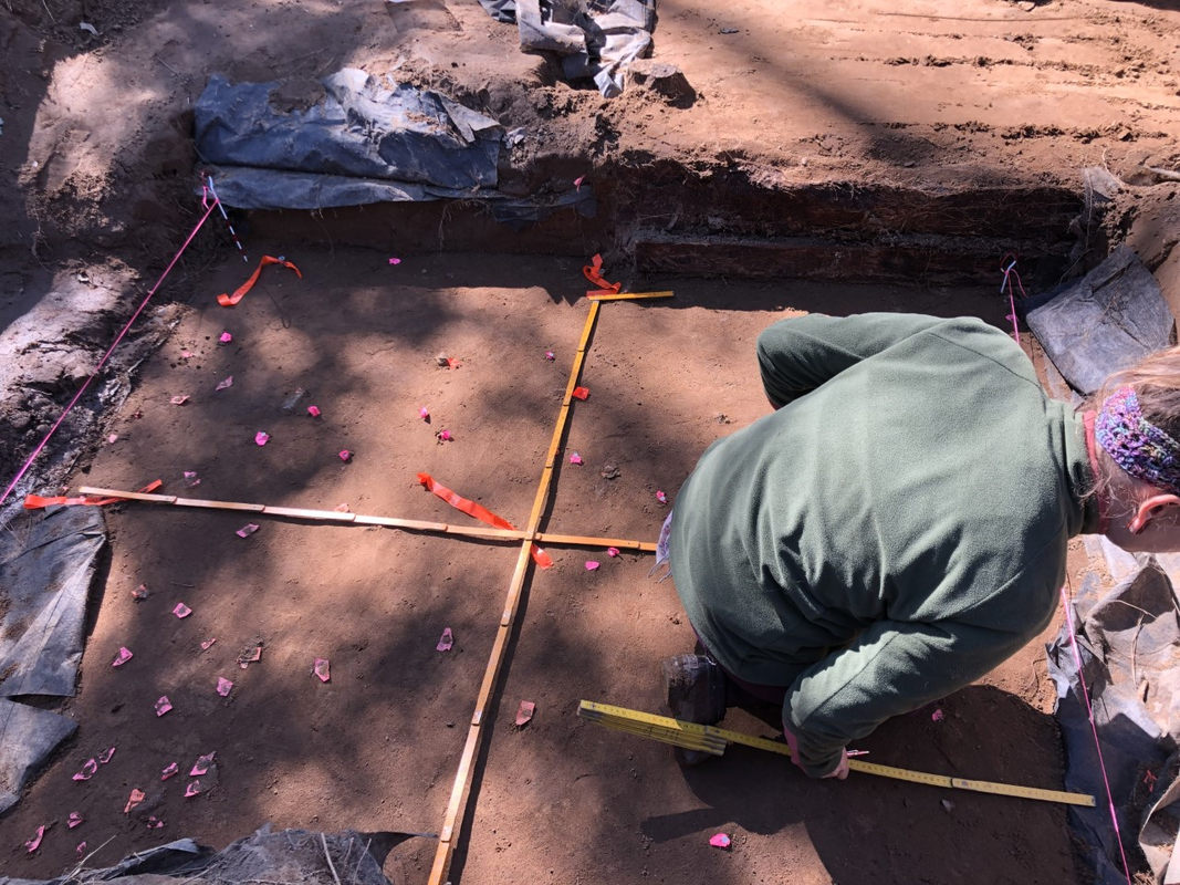 Placing rulers to aid in mapping. Now that the set up process was completely finished we began piece-plotting in the NE quadrant of our unit. I identified the northings and eastings of each artifact and read them off for Sam M. to record in the FS log and map out on the paper grid. Then, I removed each artifact carefully with my trowel and handed it to Sam M. before measuring its elevation with the laser level.
We left in artifacts that were not easily removed in order to excavate further down to their level later on, or “pedestal” them at surface level. At the end of our day Sam M. and I were able to finish piece plotting the NE quadrant and half of the SE quadrant of our unit. Meanwhile Sam M. and I were piece plotting, Robert G., Lelia, Laura, and Sami continued excavating unit 15. Robert G. and Lelia were working in the west half of the unit and Laura and Sami worked in the east half. 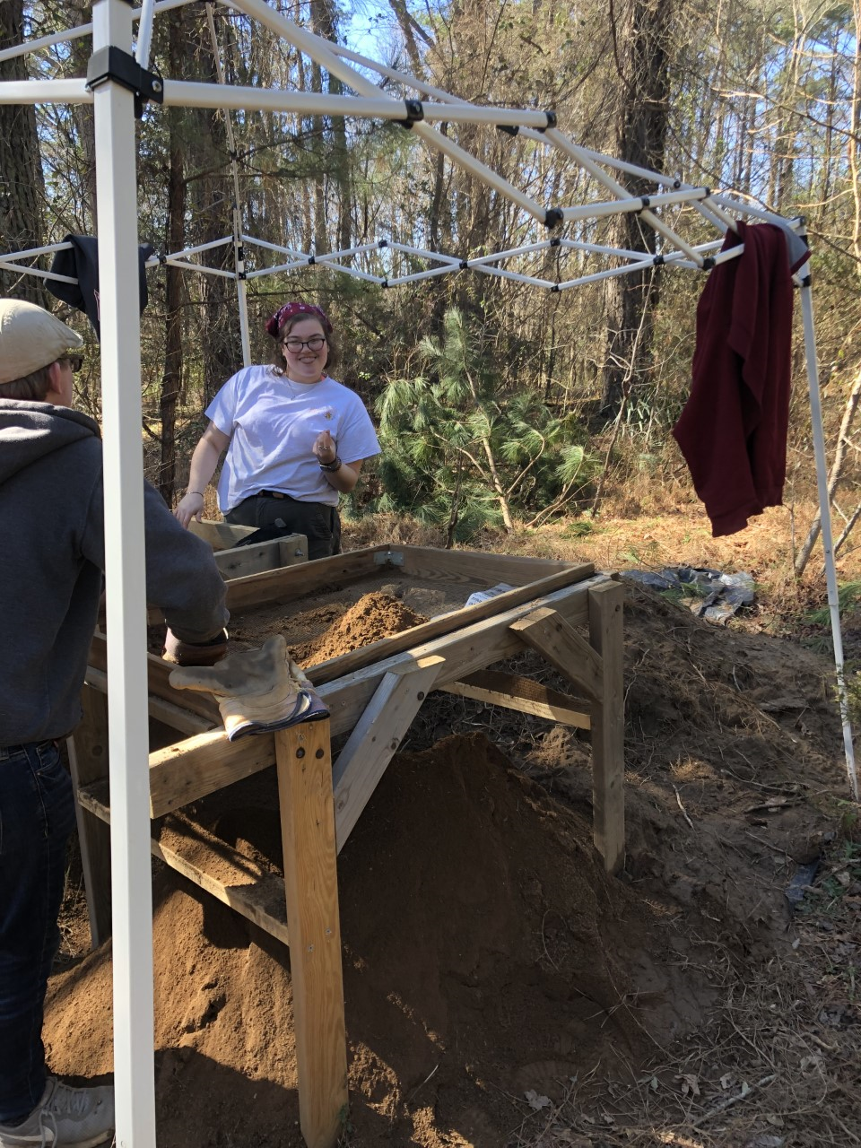 Lelia flashing her signature finger gun while screening with Fletcher. At the end of the day we properly covered all the excavation units and put away the tools before heading back to SCIAA.
0 Comments
This week was our first official full day. We arrived to find no water blocking our path to the site, making set up quick and easy. We began with the usual: we unloaded the trucks, pumped water out of the block, and got the tarp moved to an open field to dry. After setting off to begin work on our designated areas, Rob, James, and DuVal discovered that the portion of the wall they were working on excavating had collapsed. The water line indicating how high the water had reached was unbelievably high. 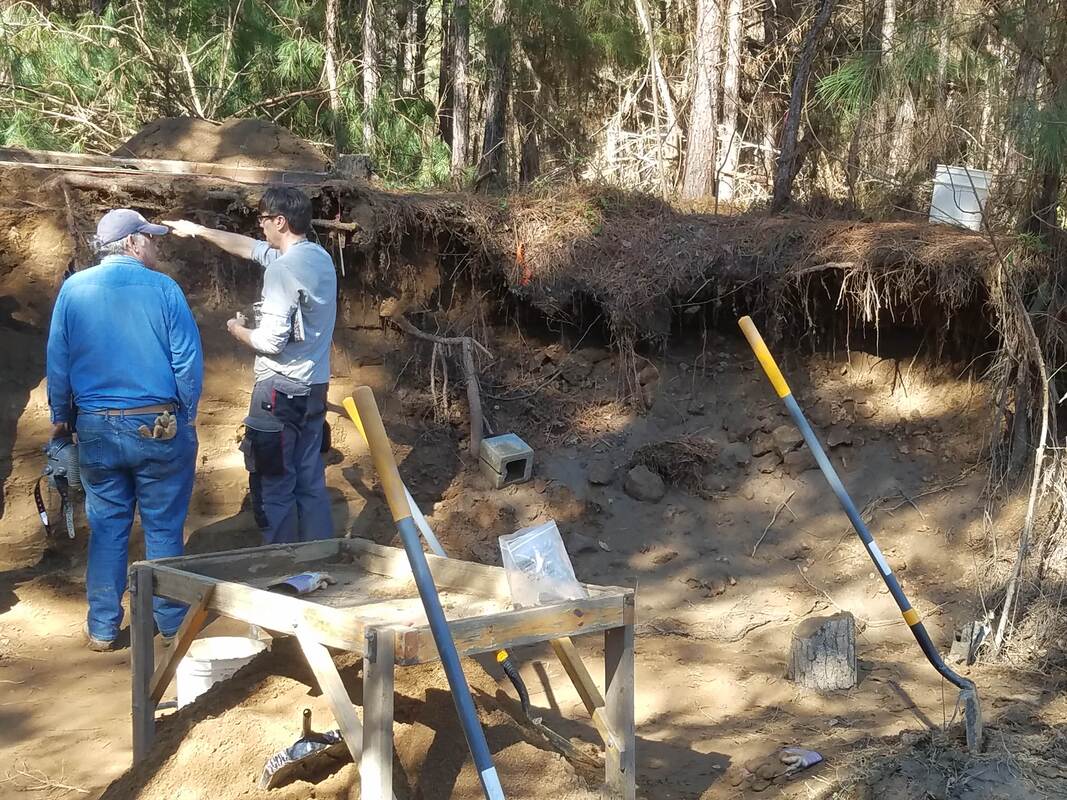 Dr. White and DuVal surveying the damage caused by flooding. Once we surveyed the damage, the rest of us got to work on our assigned units. Sami and I finished the SE quadrant of Unit 15. We removed any remaining loose dirt, checked that our walls were straight, and took our final measurements. Then, Dr. White came over and showed us how to finalize the paperwork, including using the Munsell Soil Chart to determine the color of the soil in the unit and taught us the jargon to describe soil properties, like the texture. We determined our soil was sandy loam, meaning that it’s a composite of multiple soil types but mostly made up of sand. After filing away our very first completed paperwork for an archaeological site, we began work on the NE quadrant of Unit 15. We took the initial measurements of the height below datum in centimeters and filled out the information on a new FS log entry and artifact bag. At the same time that we broke ground on the new quadrant, Lelia and Robert began digging the SW quadrant of Unit 15. Sami did most of the initial shovel work while I screened the dirt she removed on the 1/4” screen. Fletcher came over and helped Lelia and I screen our dirt.  Ready to break ground on the northwest quadrant of Unit 15. After our lunch break, Sami and I began troweling our quadrant. After troweling for a bit, Dr. White sharpened both of our trowels and we got to experience what a good, sharpened trowel could do. Man, it was so much better after it had been sharpened! However, we realized that we still had a few centimeters to go before we reached 40 cmbd (centimeters below datum), so Dr. White prompted us to use the shovel again. I began practicing taking off only small portions of dirt with the shovel and it was actually quite satisfying. As I removed what I thought to be centimeters of dirt, Sami would periodically check the depth. I say “what I thought to be centimeters of dirt” because I have found that I need to learn what a centimeter looks like. I suppose it will come with practice, but my “centimeter” was sometimes not even a half a centimeter. However, we eventually made it to 40 cmbd! Next week we will clean up any loose dirt in the NE quadrant, take our final measurements, and use the Munsell chart to describe our soil, before beginning the work to bring Unit 15 down to the next level. 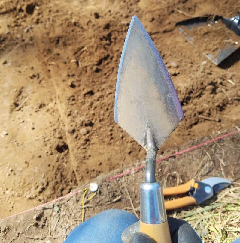 A freshly sharpened trowel. The weather for our Week Four field day was beautiful. It was not too hot or too cold, so we left to head for the site excited for our first full day of work without rain. Once on the property however, we soon discovered that the road to the site was flooded, making it impassable for our trucks. It was decided that we would try to walk upstream to a dam that had been put in in the hopes that we could cross the stream there and make it to the site. After a walk down train tracks, through some woods, and across a little stream of water, we were able to walk across the dam and make our way to the site.
It had rained considerably the day before, so the main unit was filled with water, so we worked together to empty the units and then removed the tarp which was them placed in a nearby field to dry. After this, our work could really begin for the day. My day consisted of working to level out the southeast quadrant of Unit 15, the unit that I helped to lay out in Week 2. We worked to lower it to 40 cm below the datum (cmbd). The way that we measure elevation is by using a laser level. We use the sensor and a foldable ruler and then find out how much distance is between the ground and the laser. The datum stays on a cinder block that does not move so that it can be sensed all over the site by the sensors and it does not change heights from day to day. As we scraped the dirt using the shovels and then our trowels, we collected it in buckets, which we then take to screen in our ¼” screen. So far, in our removal of Level 1, which is the plowzone, we have found one rock, a walnut, and a lot of roots. We were able to get most of our 1x1 unit level and at the right depth, but the outer sides of the 1x1 still need to be evened out since they will be the actual sides of Unit 15 when it is completely opened and lowered.
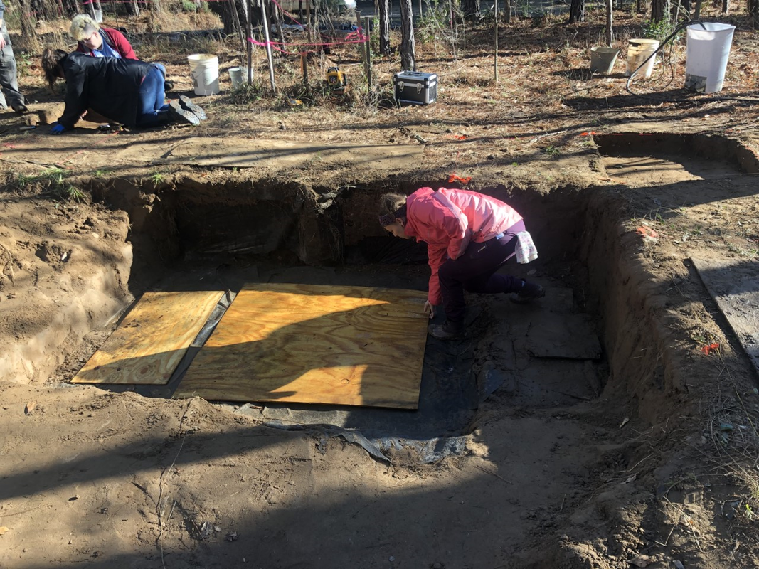
Elsewhere other units were being worked on in a similar method. In Unit 15, the northwest quadrant diagonal to the quadrant I was working on is also being opened up. They are facing a challenge with that quadrant because there was a tree growing halfway in the unit, so there are a lot of roots in the 1x1, which they are having to contend with. Over next to the wall, a 1x3 unit (Unit 14) was measured out and then started getting opened up in an attempt to stop any more loss of the wall from the collapsing that has been happening. Unfortunately, we did have to start packing up a little bit early because of the long walk back to the trucks, but overall it was a productive day and things are really starting to get moving. When we were tarping the open units (which we do to prevent rain from getting into them) the wind proved to be tough to contend with and the giant tarp did not want to flatten itself down into the units, but eventually we were able to get the tarp into the units and weigh it down with buckets of back dirt. The tarp has to be placed into the block, and not just over it, because we don’t want to fight with the water, we want the water to collect in the tarp to protect the block. We put our tools away in the toolbox and made our way back to the trucks, the day over.
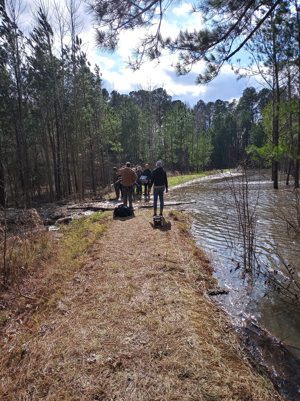
Today was probably the most challenging day in the field so far. We have been cursed with bad weather this semester. Approaching the site, we had to stop because the road had become flooded due to persistent rain overnight. Dr. White used his handy map skills to scout out a detour. Just like Bilbo, we were going on an adventure. The detour took about 25 minutes on foot, but we were able to reach the site. Just as expected, the main block was flooded with a good amount of water. Most of the class stayed at the site and started to bail out the water. Robert, Laura, and I went on a special mission with Dr. White to retrieve some equipment from the trucks. Among the items brought back was our good luck charm. (Maybe one day it’ll actually bring us luck). 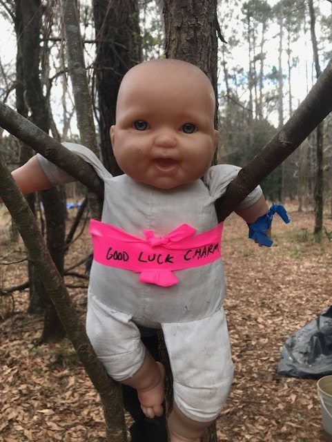 Our good luck charm. Back at the site, we set up a pump and helped bail out the remaining water. We then wrestled the tarp through windy conditions to unveil our units. Almost two hours into our day, we were finally able to start the real fun. Cate and I continued work on our 1 x 1 meter unit (Unit 16). I shoveled while Cate screened. The first level of Unit 16 needed to end at 50 centimeters below datum (cmbd). When I got close to 47 cmbd, I switched from shovel to trowel and Cate came over to help me level out the floor of the unit. It proved to be harder than we first anticipated. We were being cautious and taking measurements with the laser level constantly, but we kept going 51 cmbd in some areas. After a few helpful tips from our fearless leader, Dr. White, the troweling became much easier. Cate and I couldn’t finish the plow zone level completely before it was time to pack up, but I was pretty pleased with how much we accomplished and learned. 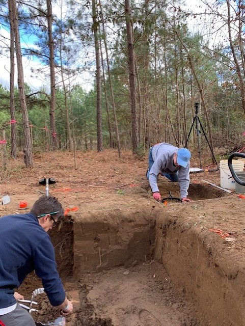 Me troweling with my good friend, Dr. White. Today posed a little bit of a challenge to all of us. It rained very, very heavily on Thursday, and when we drove up to the dirt road that leads to the site, we found that it was completely flooded and would not be possible to drive or walk across. 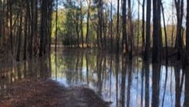 The road to the site: completely flooded. We realized that if we wanted a chance at doing any digging today, we would have to find another route, so we set out on foot walking parallel to the Broad River to see if we could find a path on higher ground that would not be flooded. Surprisingly, after walking for about a half an hour (and fording a stream), we were actually able to reach the site without having lost too much time. As we expected, the upstairs block was completely filled with water that would have to be removed before we could get to work. Unfortunately, the water pump was still back in Dr. White’s truck, so while he and a small crew went to retrieve it and some other equipment, the rest of us got to work bailing the water out with buckets. Dr. White set the pump up when he got back and we continued bailing, but all in all it took at least an hour to clear all of the water out. Finally, we were able to remove the tarp and get to work. 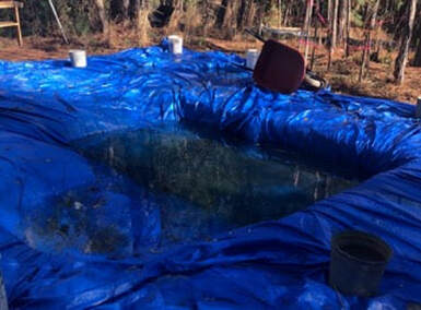 The unfortunate result of Thursday's rain. Everyone kept working on the new units that we are opening up, and Zoe and I continued working on the first level of Unit 16 in the southeast corner of the block. Zoe shoveled while I screened, and we found a few rocks (including one pretty large one) and a few small pieces of rusty metal that appeared to be iron. Our level goes down to 50 cmbd, so once we got close to that depth, we both started troweling to straighten our walls and level out the floor. We realized that, even though we had both been very concerned and cautious about not going below 50 cmbd (centimeters below datum), our floor still dipped to about 51 cmbd in a couple of places. That isn’t the worst thing since we are digging in the plow zone, but we were wary of accidentally going any lower than that, so we spent the rest of the day troweling slowly and meticulously, while frequently (maybe obsessively) measuring our depths with the laser level. 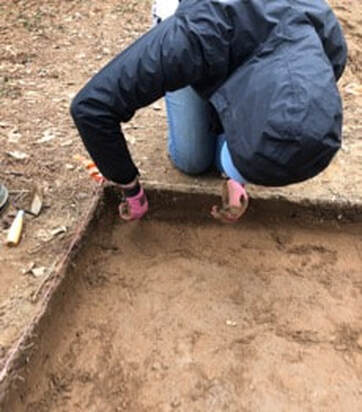 Zoe troweling the corner of Unit 16 We got close to finishing, and our walls were pretty straight, but we were not quite able to get the floor level by the time we had to pack up and walk back to the trucks. Hopefully with more practice I will be able to finish troweling a unit a lot faster, but we were both happy with the way our unit is looking. We had a surprisingly productive day given how it started, but we are all hoping that next week we will be able to truly have a full day in the field and really make some progress on our units.
For day 3 of our field school class, January 31st, 2020, it started raining about 30 minutes after we arrived at the site. When we got there, the tarp covering the block (Units 3, 4, 5, 6, 12, and 15) was filled with a lot of water. We formed a line and filled buckets with water and passed them down the line to make sure the water was dumped out far enough away from the units. After about 10 minutes of scooping all the water out of the tarp, we all carried the massive tarp to the field about 100 feet away.
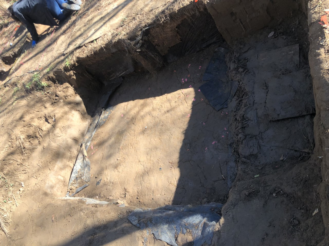
We started excavating the first level of Unit 15 with shovels and after about 10 minutes it started raining pretty abruptly. Unfortunately, it was supposed to continue raining all day so we decided to call it quits and put the tarp back over the units. The tarp had filled with water in the short amount of time it was sitting in the field, so we had to maneuver it to drain all the water from it before we carried it back to cover the units. Once we had gotten the tarp back over the units, we used backfill dirt to fill the buckets to put them on top of the tarp to weigh it down. After we had cleaned everything up, we headed back to campus and had a short break for lunch, then watched all the videos from the field school class from 2018. It was interesting to see what kinds of things we will be learning later in the semester. We got to see footage of things we have not gotten to yet, such as piece-plotting and excavating with trowels. Throughout the first three days of the class, we have not found any artifacts in context, because all of the areas we have screened so far is dirt that has fallen from the wall “downstairs” or the ground level of Unit 15 “upstairs.” It was interesting to see what it is like to find artifacts in context and features like where a firepit was located or where a post went into the ground. Although it rained shortly after arriving at the site, it was still a productive day and I am glad I have more background information about the site. Hopefully the weather is better this week! At the site on Friday, January 24, 2020, we were working to sift through the slump from a wall that had collapsed before we had returned to the site to begin work this season. We did not find many artifacts in the slump. There were several bits of fire cracked rock (FCR). Once we had gotten through the slump, we worked to re-expose a portion of the wall, which had previously been excavated. Unfortunately, during the time the site had not been being excavated, the structures that had been put in place to preserve the site had become rotten. The dirt behind the protective structure had become unstable.
Therefore, as we removed the dirt which was anchoring the protective structure, the structure and the wall collapsed. This created more slump. This was incredibly unfortunate, as it took the artifacts within this area out of context. This means that, while we can say that a certain technology or item was used in this area, we cannot say when. Given the possibility in this space, it could have been used at any point over the past 7000 or more years. Because the wall collapsed, we lost the stratigraphy. While stratigraphy is not necessarily an exact dating process, it is a reliable relative dating process, which can tell us in relation to other things when things were used or happened. As archaeologists, context is incredibly important. Not only is context what allows us to date artifacts and identify the cultures they belonged to, context is what separates archaeologists from simple looters (along with the interest in a monetary reward for a find). While looters grab at anything shiny and destroy any context in doing so, archaeologists work tirelessly to document and maintain contexts, even though archaeology is an inherently destructive process. Once an artifact is taken out of the ground, it cannot be put back in the ground and have the validity or accuracy of a pristine find. This is why it was important that I also spent time on Friday doing an exercise on mapping and setting up grids, so that I could learn how to preserve context as an archaeologist. We left a bit early, but thanks to modern technology and in-hand radar devices like cell phones, we were able to prepare for our departure before any real weather event happened. |
Student Blog (2020)Blog posts written by the students of the 2020 Broad River Archaeological Field School Archives
April 2020
Categories |
 RSS Feed
