|
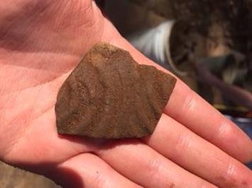
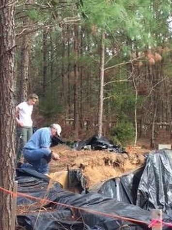
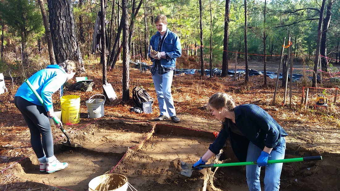
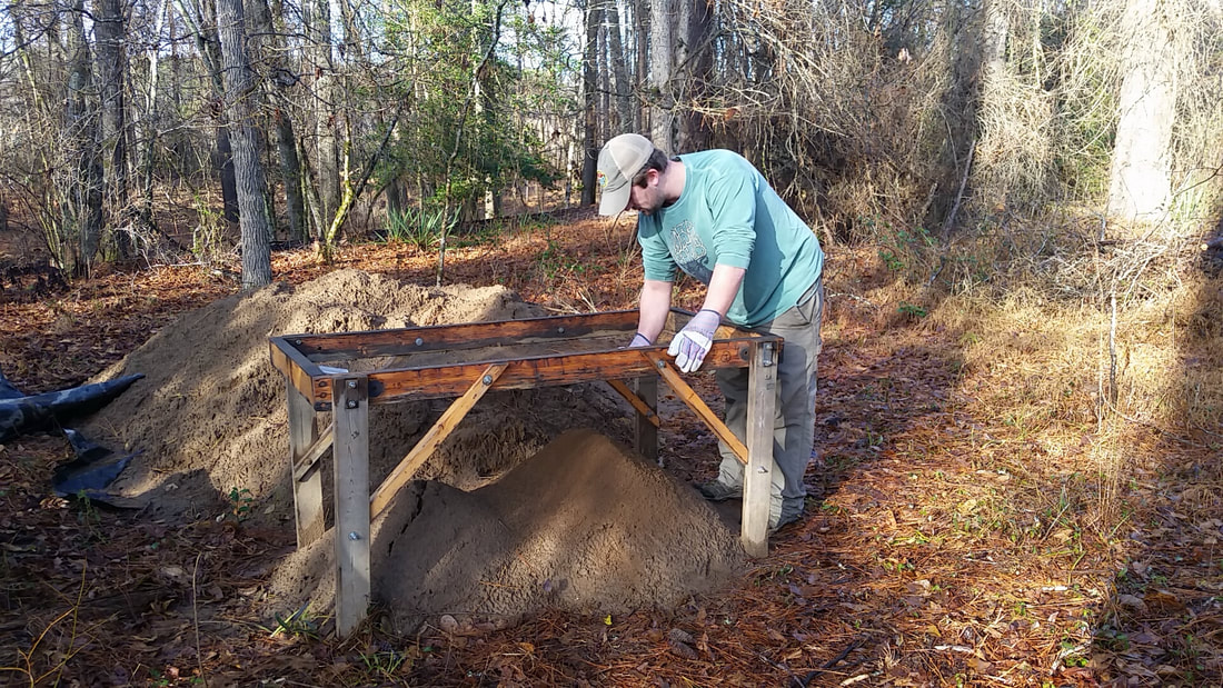
When we first arrived back at the site we started off by removing the tarps and starting a pot of coffee. We were greeted by the fortunate sight of no water in the block so we did not have to waste any time bailing water. I was back in Unit 12 with Robert. We just had a little bit of Level 4 to finish off so we got that all smoothed out for photographing. Level 4 was very rich in potsherds, as well as having a feature in the northwest quadrant and a historic posthole in the northeast quadrant. After having a look, Dr. White decided he wanted to board off about two thirds of the unit with landscaping fabric and particle board so we could have somewhere to sit and for us to piece plot the southern third of the unit. Piece-plotting is where you go very slowly with a trowel and dustpan and stop every time you hit something to flag it. Once the unit is full of flags we are going to map their locations out. We did not have to start a bag for this level yet because we have yet to catch anything in the screens: this is a good thing because it means we have been very careful with our piece-plotting. 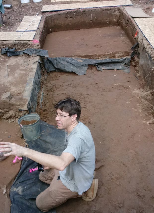 Unit 12 in the background, Dr. White in the foreground. Ella and DuVal finished off Level 1 in Unit 13, which is along the cut. They found fire-cracked rock, flakes, and pottery. After that they continued on to Level , excavating the second plowzone as a natural level. Over in Unit 5, JJ and Sam continued to trowel scrape and piece-plot. There where two decent-sized rocks in their unit. The smaller of them turned out to be a greenstone axe head. The larger one Sam had started to uncover last season and was very happy to finally remove. It turned out to just be a big rock. 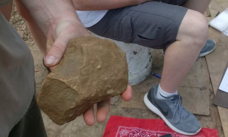 Axe head from Unit 5. Axe head from Unit 5. Caroline was over in Unit 3, starting about 40 cm below datum and continuing down to the base of the upper plowzone (shoveling and shifting only). She found some potsherds, including plain, and some with stamping and punctate decoration.
Finishing up Dr. White had purchased an enormous 50 foot tarp that could cover the entire opened area of the site. This both made closing up easier and should make reopening and closing every week much easier.
0 Comments
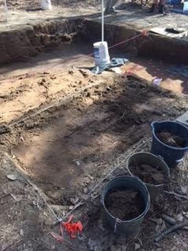
We were greeted today with water-free units and some animals that had taken up residence under the tarps. After safely evacuating a family of mice and handling a worm snake that had made its way into the excavation block, we were ready to start Day 6 of our dig. We pretty much kept to the same tasks as last week. In Unit 13, DuVal and I continued to carefully excavate in natural levels. By the end of Level 1 we had uncovered a fair amount of sherds, flakes, and fire-cracked rock. This isn’t surprising considering that we are digging over a known feature, and we are hopeful that more artifacts will continue to appear as we move closer to the feature. After taking depths and finishing the Level 1 paper work, we carefully continued into level 2 where we stopped for the day. This unit has been a bit tricky, as its location means that we must dig very carefully to keep the wall from collapsing. The shape of the unit changes somewhat as we go further down thanks to overhanging dirt, but through careful paper work and troweling we have managed to avoid any disasters. If I have learned one thing from this unit it is the importance of field notes! 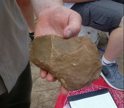 Axe head found in Unit 5 Axe head found in Unit 5 There was very exciting news out of unit 5, where JJ and Katie continued their piece-plotting. Not only did they completely uncover Sam’s rock, but the other rock in Unit 5 was revealed to be what looks like a stone axe head! We were lucky to be able to observe this artifact in situ, and its excellent condition makes it a great complement to the other artifacts collected this semester. Over in Unit 3, Caroline and Sam continued their excavation work starting from about 40 cm below datum. Carefully shoveling instead of trowelling, they made it to the end of the plowzone by the end of the day and had recovered some interesting plain and punctate pottery. Ben and Robert continued to excavate Unit 12. This unit has produced lots of decorated pottery sherds, and today was no different! They finished up zone 2 and began to work on zone 3 (below plowzone), where they started piece-plotting. 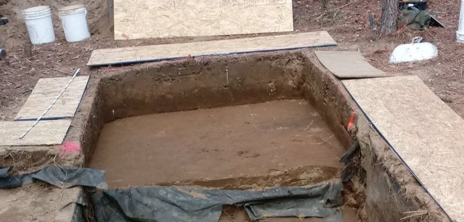 Unit 12 excavations in progress. Today’s work marked the halfway point of our fieldwork, and it was a very productive day at that. (It isn’t everyday that you find a stone axe!) Hopefully the good luck and warm weather will continue for the remainder of the semester.
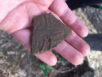
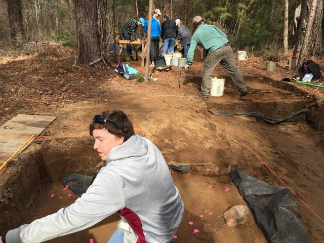
Day 3: this one was a little bit hectic. I was with a group working on Unit 12, where we broke ground the previous week. The other group was piece-plotting the items found in Unit 5 and then removed items that were exposed that they believed would not disturb too much of the soil (see JJ’s post for more details on what occurred in Unit 5). Having made two 1m x 1m units, we were now going to connect them with two more 1x1 units, making a large 2m x 2m unit. These units were still segregated in sorting and bagging, however, the plan was once it was all level it would be one 2m x 2m unit. 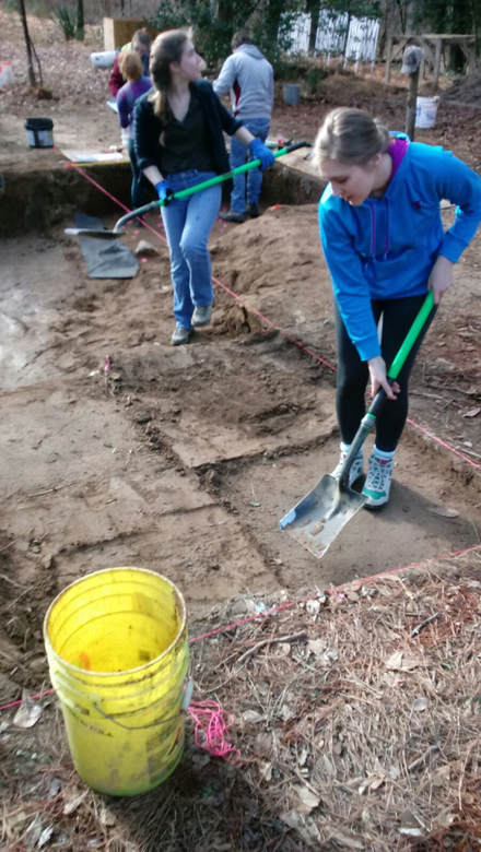 This worked out relatively smoothly. Despite my clumsiness I did not crack any walls or damage the site. We had help from a small group of DNR people and students who where interested in archaeology and they made the shifting go relatively faster. Once our unit turned into a nice and level 2x2, we were to take it down to the base of the first plowzone. A plowzone is a layer of dirt that is a distinguishably different color and is caused by people in the past plowing the land and disturbing the natural layers of the dirt. On our way to digging it down to the plowzone we found a very interesting piece of pottery, it featured kind of a wavy characteristic to the upper lip of it. 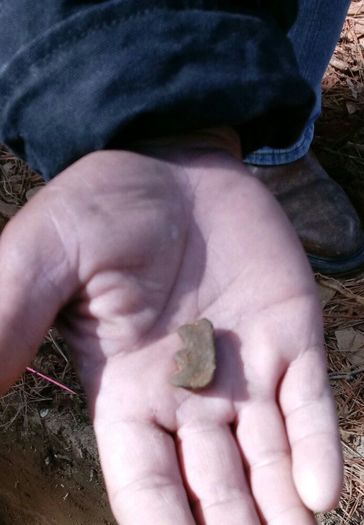 Once we got to the base of the first plowzone (the base of Level 2), and made it nice and level we were going to learn how to properly take a photograph of the unit. This involved clipping back as many roots as possible so that they would not be present in the picture. After that was taken care of we set up a board with all the important details of the site on it so that later in the lab we can tell exactly where that photo was taken. This board included the site’s designation (38FA608), the unit, the level, and the date as well as an arrow pointing north placed in the unit next to it. 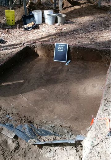 Overall take away from this week, is I learned to be more careful and methodical in my actions while at the site. I nearly damaged our unit multiple times through careless error and only did not by luck. However, this day was overall enjoyable as have been all the days working on this site and I look forward to getting dirty again next week!
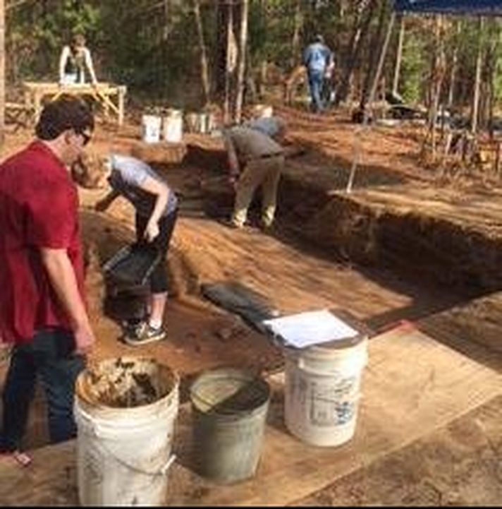
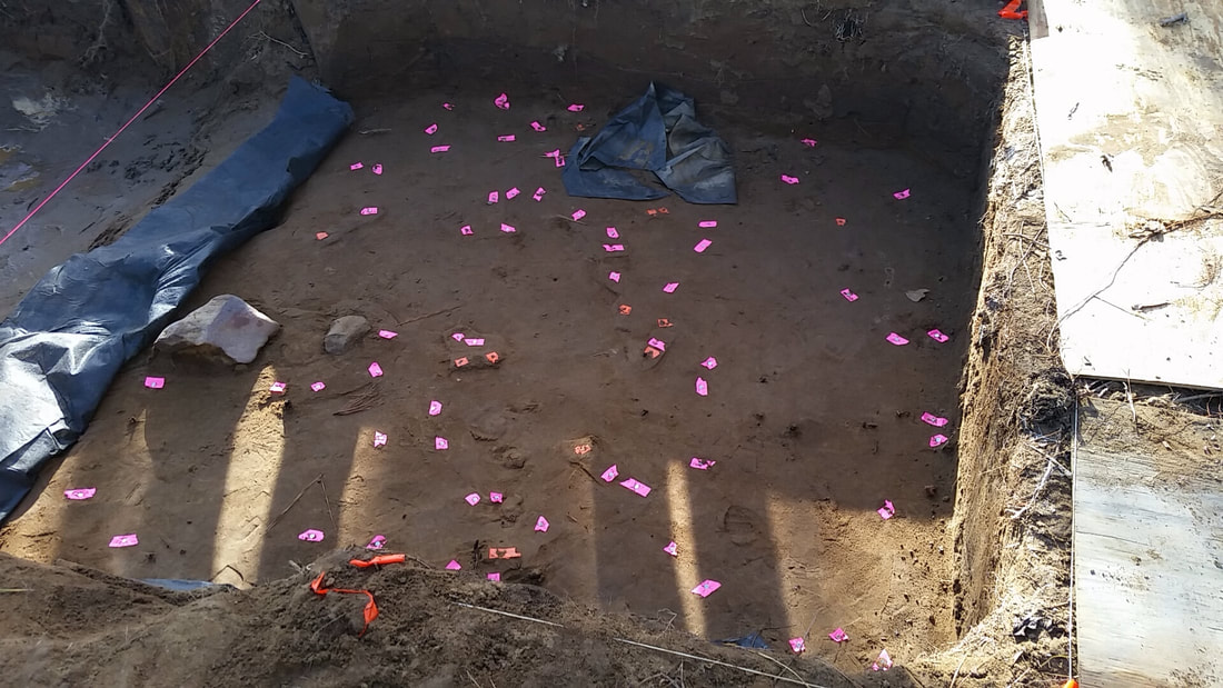
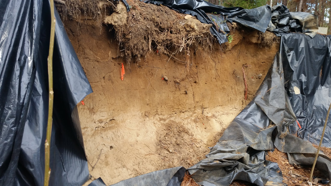
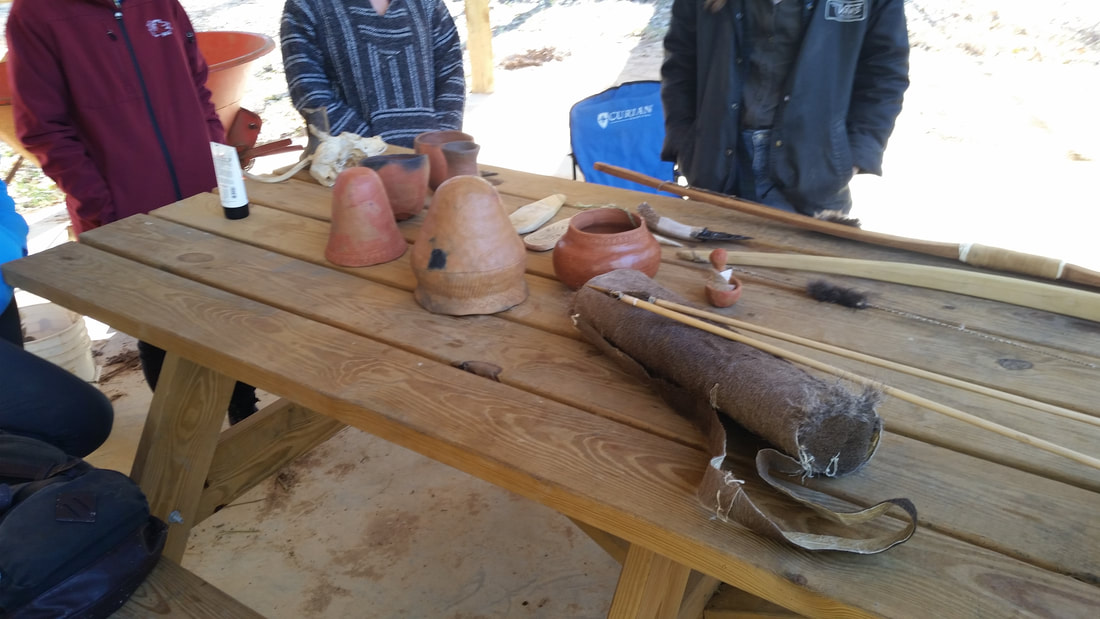
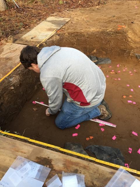
Holy Cow! Day 3 is already done at the Broad River Site in the Archaeological Field School! The morning started off with us removing what water had accumulated in the excavation block of the "Upstairs" of the site. The water wasn't too much but was just enough for us to spend a little bit more time on to ensure that we were able to properly continue. As we continued our excavation at the site, Dr. White informed us that we would have some visitors today not only from the Department of Natural Resources (DNR) Heritage Trust, but also some students from a couple of local schools observing us work at the site. While we were being observed, our class was split into two separate groups. One focusing on the piece-plotting of artifacts that were found in Unit 5 on Level 7, and the other focusing on the deepening of Unit 12 past the plowzone. Both process for each of these Units took up the majority of the time throughout the day. Sifting and excavation continued throughout the day, as samples were taken not only of small fragments of broken pottery and flakes that were found in Unit 12, but also of pieces of burnt clay, debitage, and portions of charcoal that were found on Level 7 in Unit 5. Debitage, which is all the material that is produced in the lithic and stone tool process that could range from flakes, shatter, debris, and even blades or rejects from the production process, was the main source of artifacts that were recovered from Level 7 of Unit 5 throughout the day. These individual pieces of debitage were "piece-plotted"; a method of placing the artifacts precisely within the unit along specified Northings and Eastings in relation to the site's datum. This in turn allows us to be able to see the spatial relationship that the multitude of artifacts have with one another across the various levels of the unit. These individual artifacts are then entered into the FS Log (Field Specimen Log) with the information surrounding its removal from the unit as well as it being plotted on a Excavation Unit Form, which contains several important notes about who was working on the particular unit, the exact Northing and Easting of each of the corners, as well as the beginning and ending depths of the unit. Towards the end of the 3rd day of excavation, Dr. White also introduced us to what we were planning on doing in the "Downstairs" portion of the site, in which we will be crosscutting into the side of the exposed hill. Closing for the day, one of our on site pros, Robert, who works for the DNR, showed our group some recreations of ancient tools that he himself had made as a way for us to better visualize what these remains may have gone into making, whether it be a fire tempered clay pot or a flaked projectile point that was later used for hunting in the local area on the Broad River.  |
Student Blog (2018)Blog posts written by the students of the 2018 Broad River Archaeological Field School Archives
April 2018
Categories
All
|
 RSS Feed
